Role: Lead Level Designer
Saints Row
Engine: In-house CTG Engine
Highlights:
Lead a team of 4 - 7
Designed the main city map and DLC expansion cities.
Main district designer for several districts
Laid out and maintained road networks
Created blockouts for city blocks and interior mission spaces.
Implemented open world infrastructure and ambient life placement.
For on DLC projects and ambient systems click the buttons
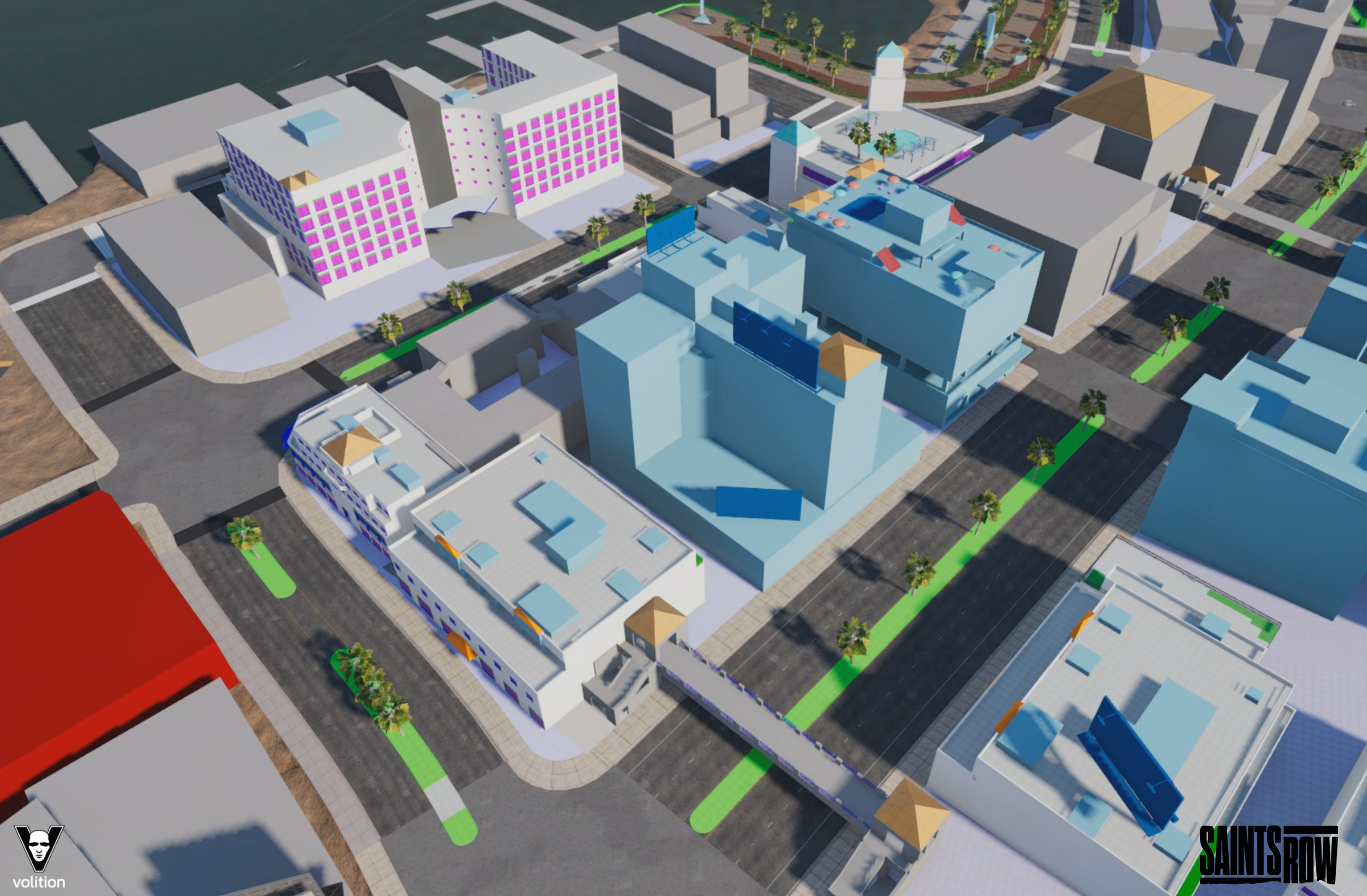
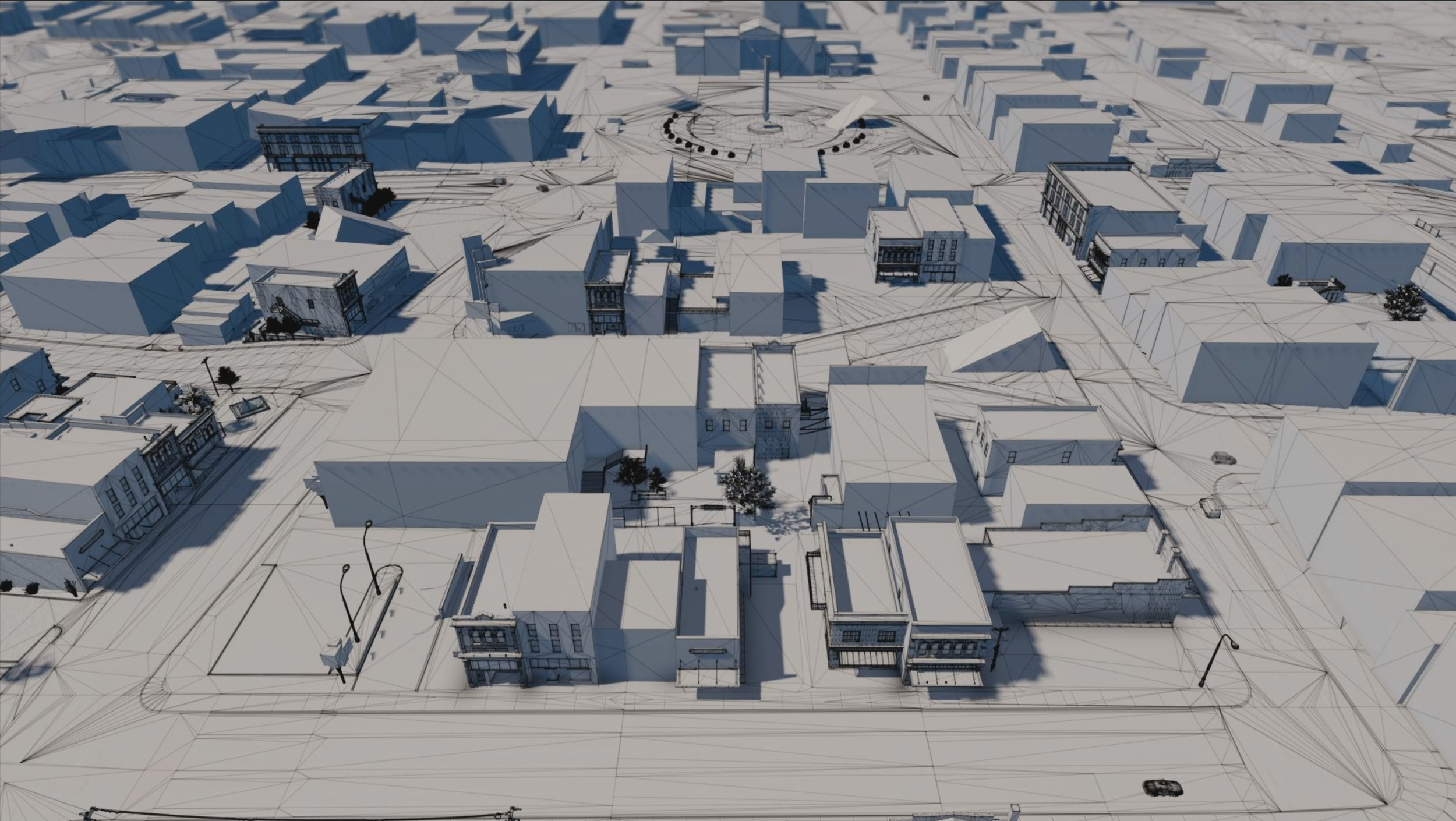
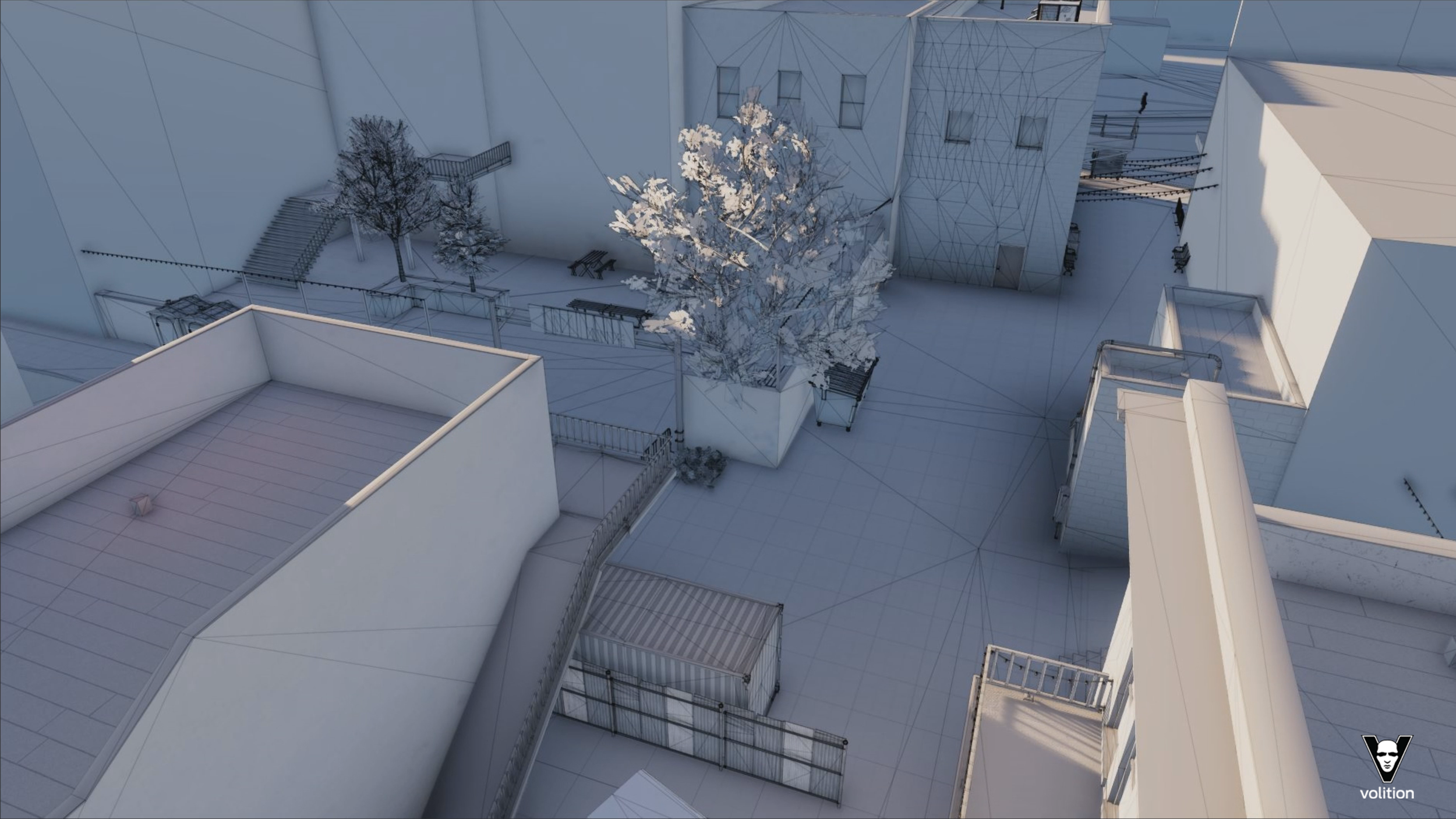
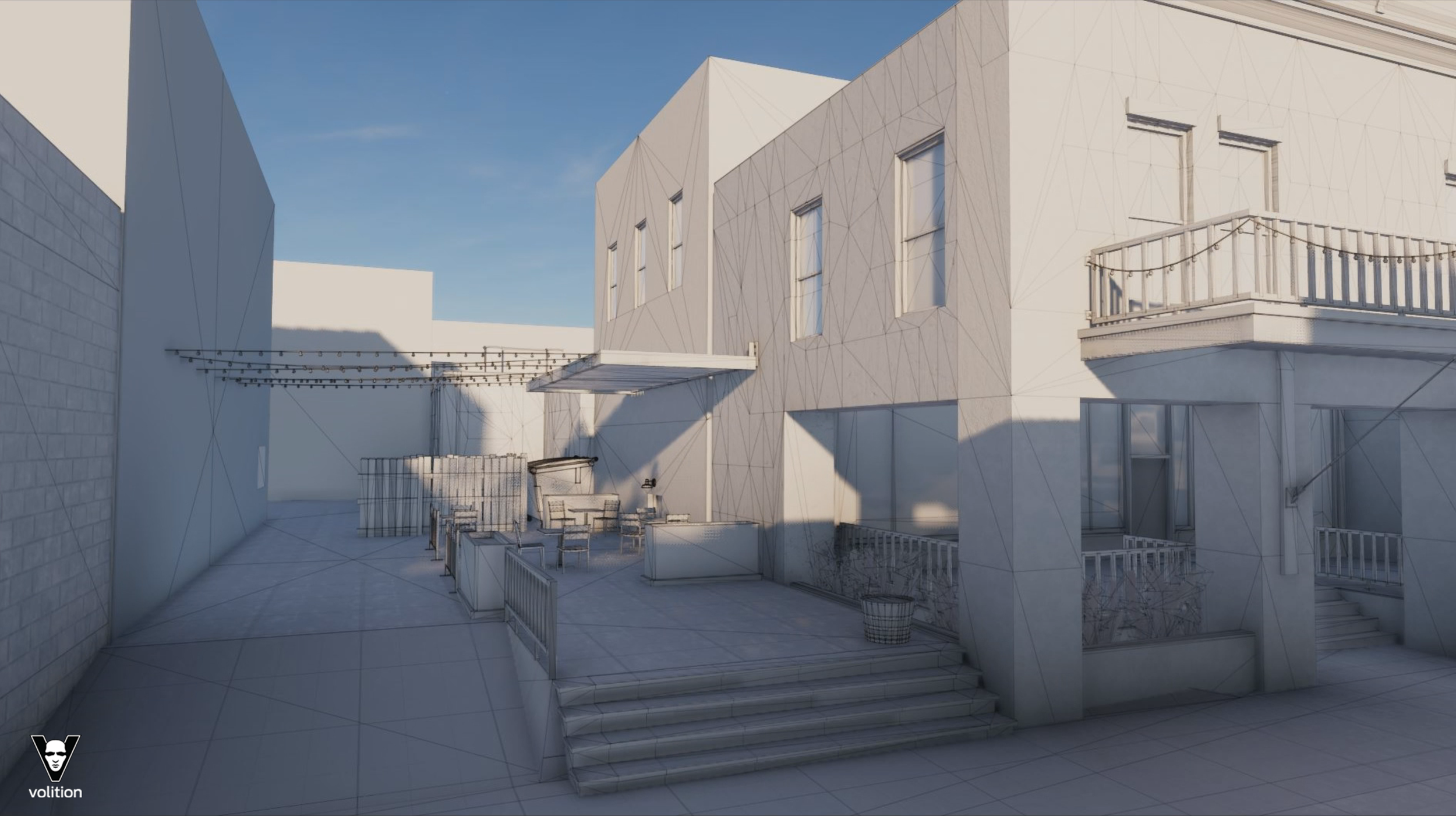
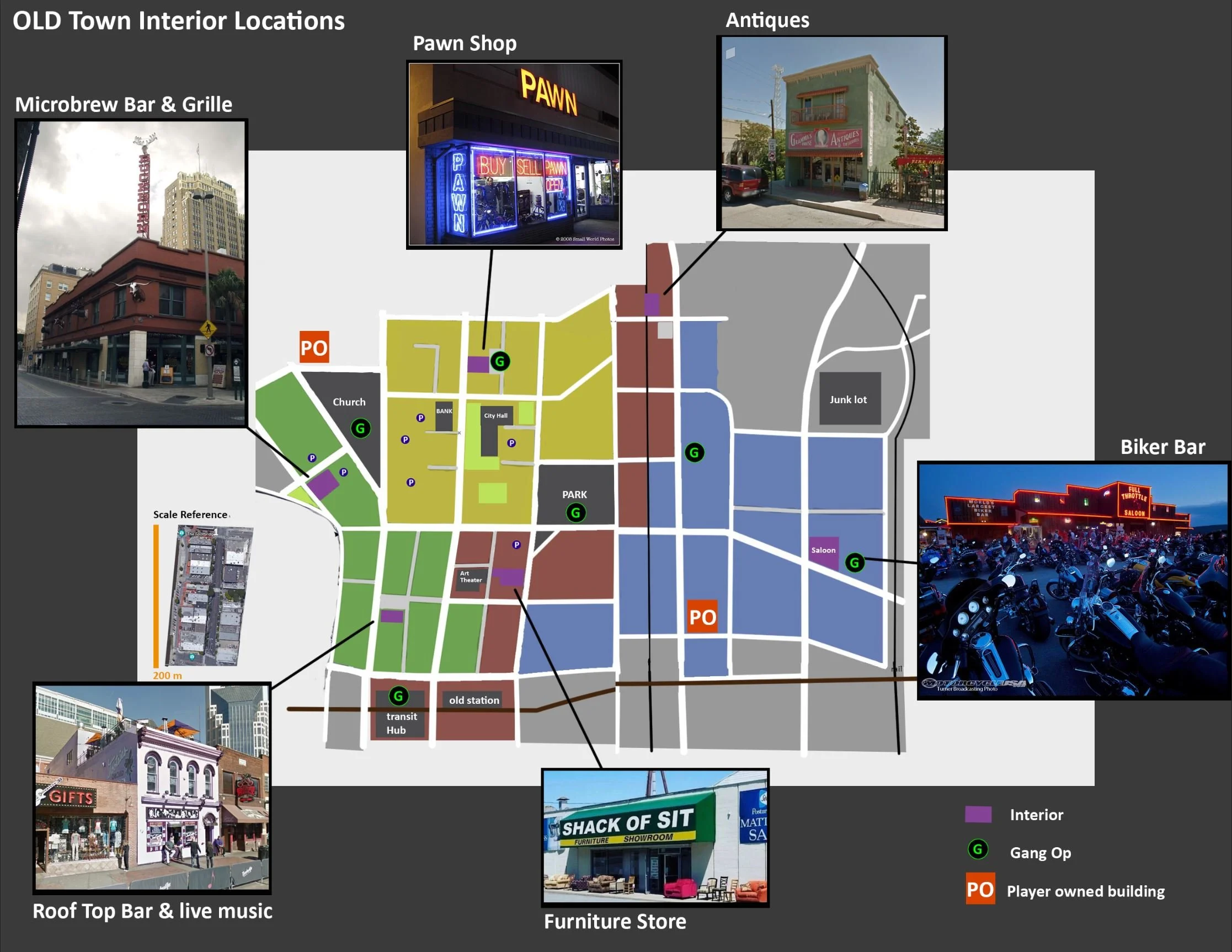
Here are a few examples of blockouts that I made for the Old Town and Marina Del Lago districts of the city taken from scratch all the way to to final. I was the main Level Designer for these districts overall, which means I laid out the entire road network and painted in major elevation features. I built the first pass blockouts for the city blocks and designed any gameplay-significant spaces/structures as needed. Green structures are prefab kit buildings created by Artists; anything else was built by me. Blockouts to Final

A number of structures were based on hotels in Santa Monica, CA and Rodeo Dr. Every location started with extensive research & reference gathering.
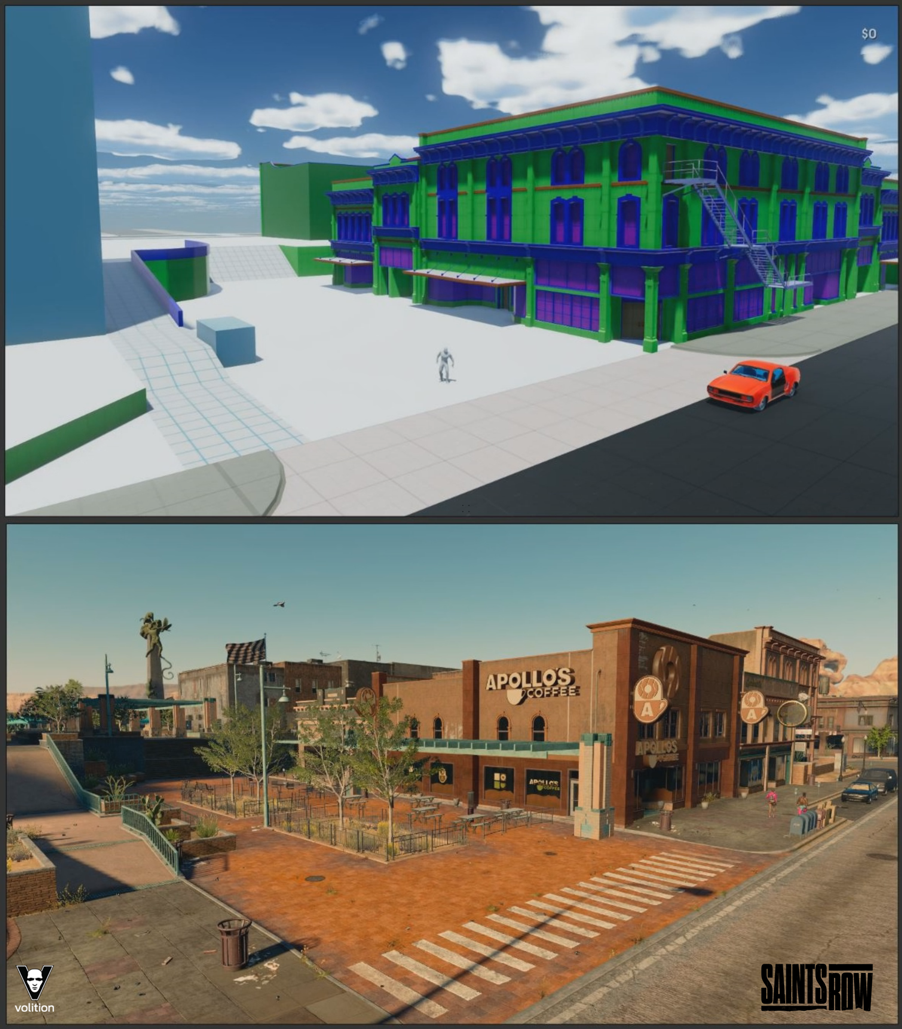
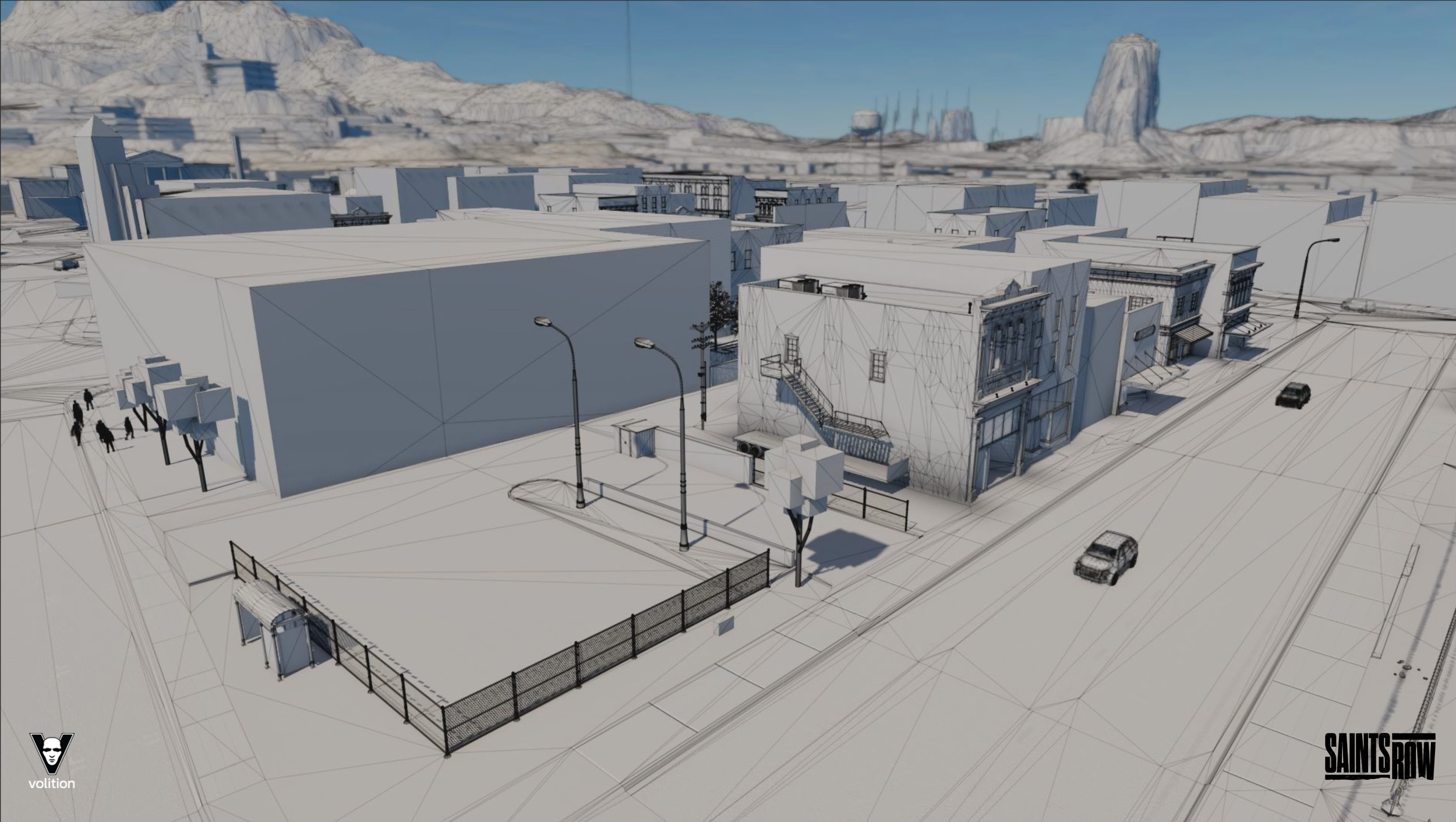
This the first test block built for the Old Town District, the Old Town city hall. The main goal at this phase was to establish the correct scale, getting a space for feel right for on-foot and driving. The inspiration for the block came from a real block in my hometown.
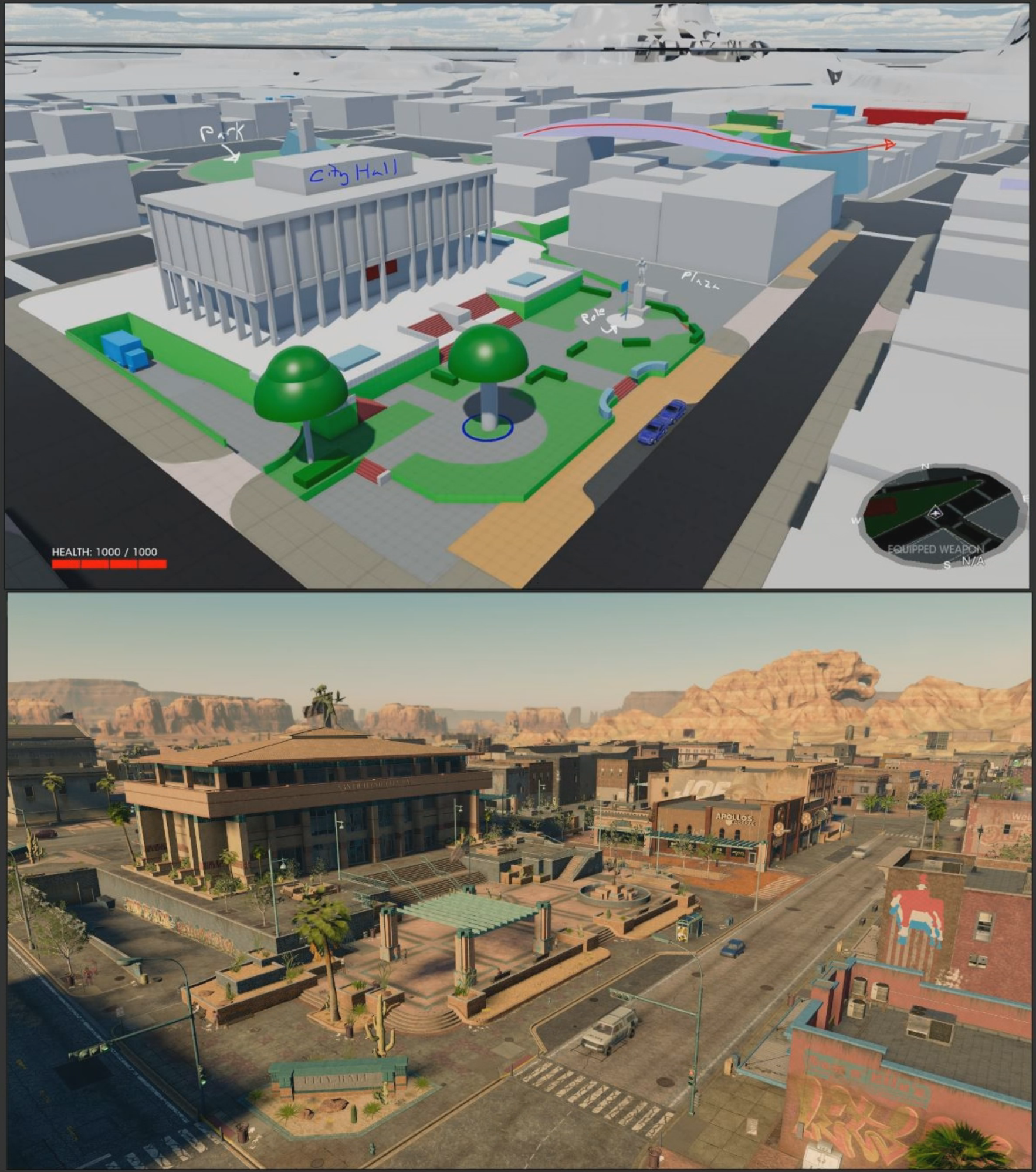
The city hall block for the Old Town District. The starting point for city.
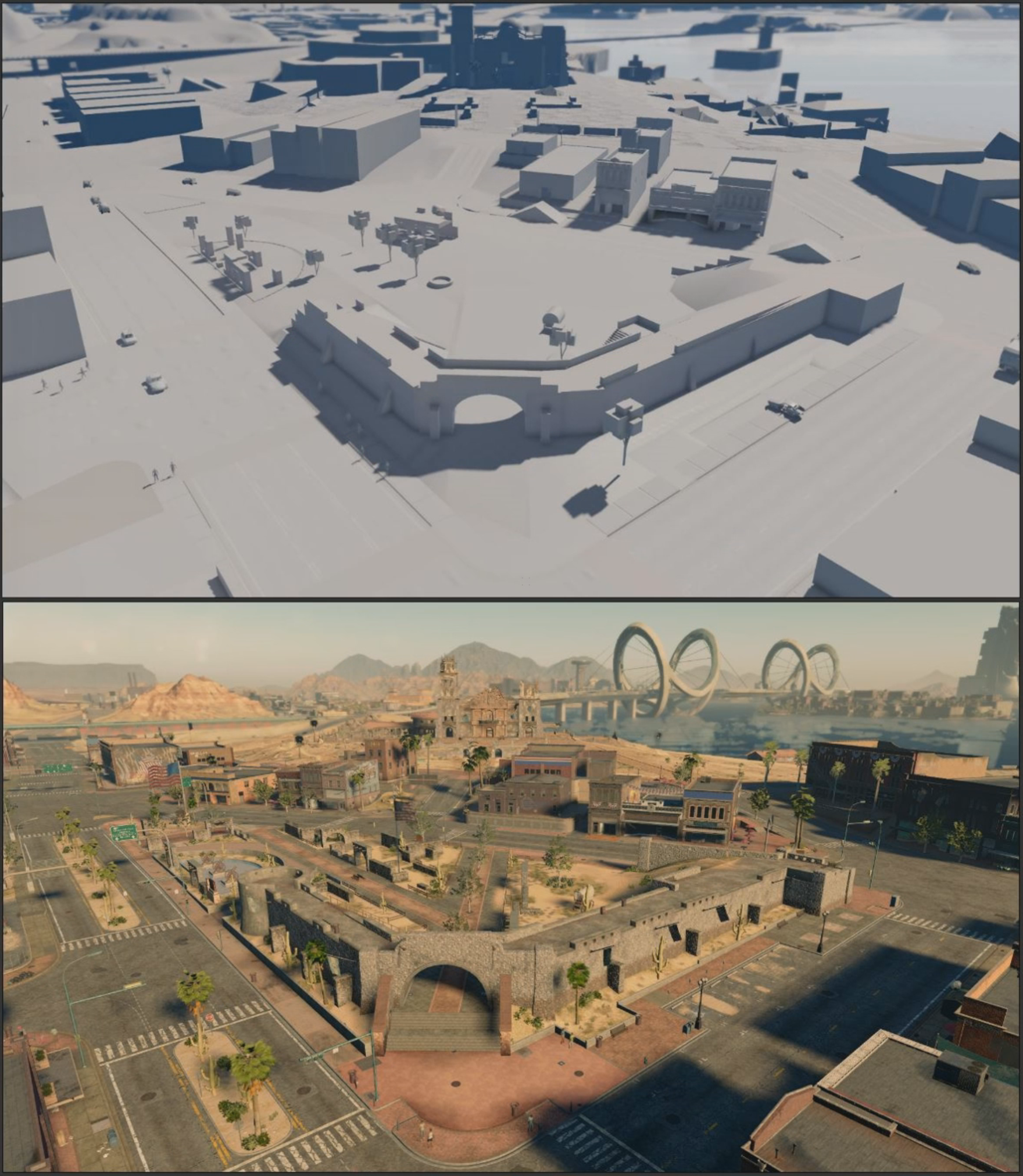
Fort Cullen, loosely based on the Alamo. The Original fort was designed as a series of vehicle ramps, shortcuts and stunt area. Over the course of development the needs of the block shifted to more around on-foot gameplay.
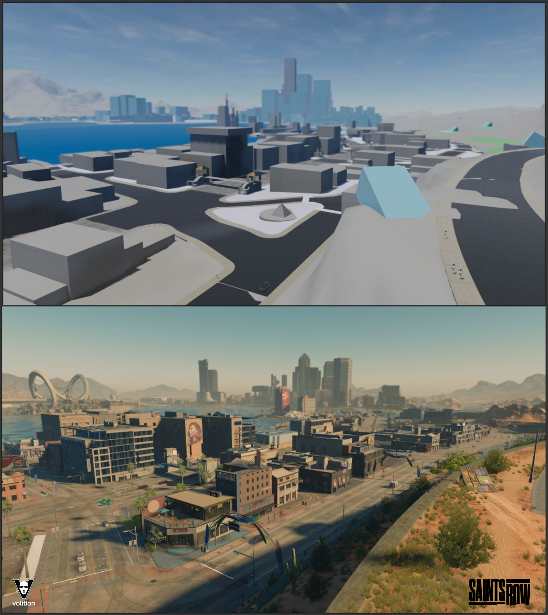
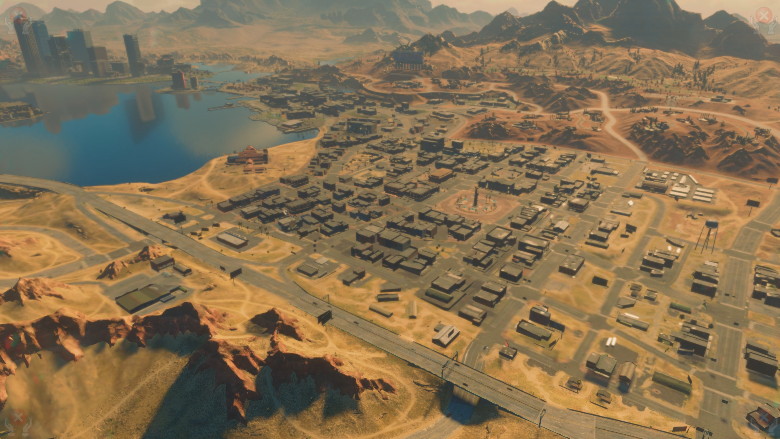
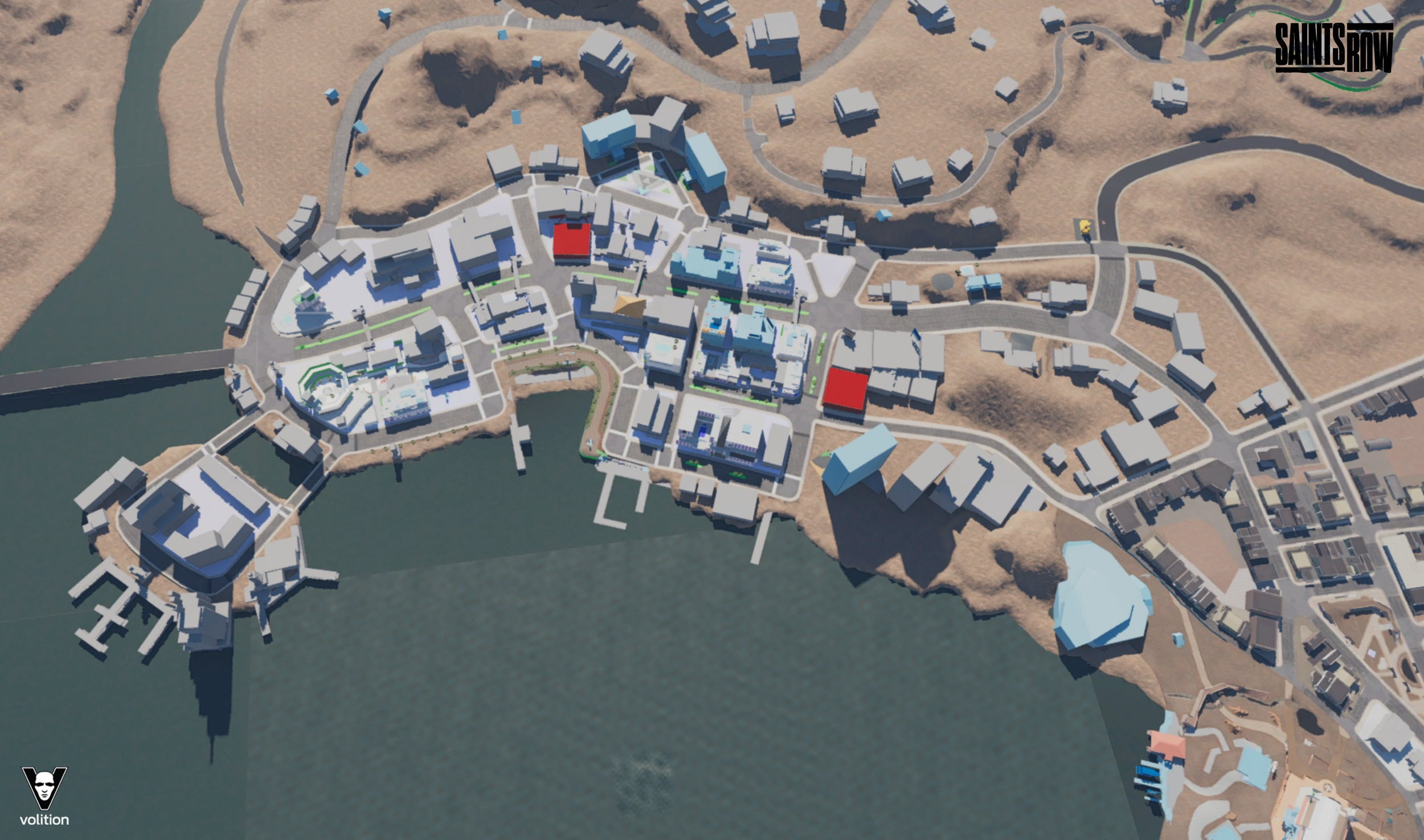
The first of the Marine Del Largo district with a view of the downtown skyline.
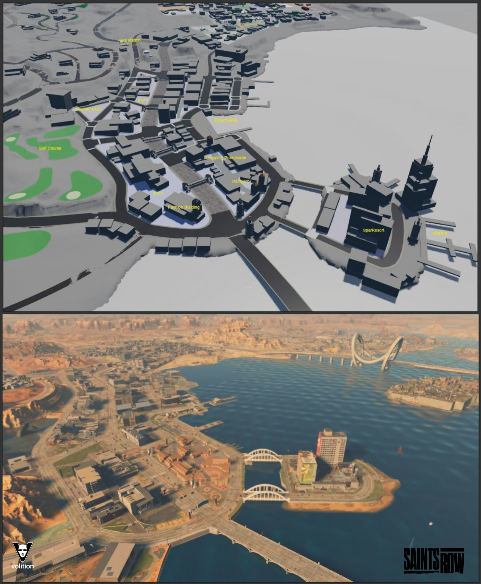
Birds eye view of Marina Del Lago.
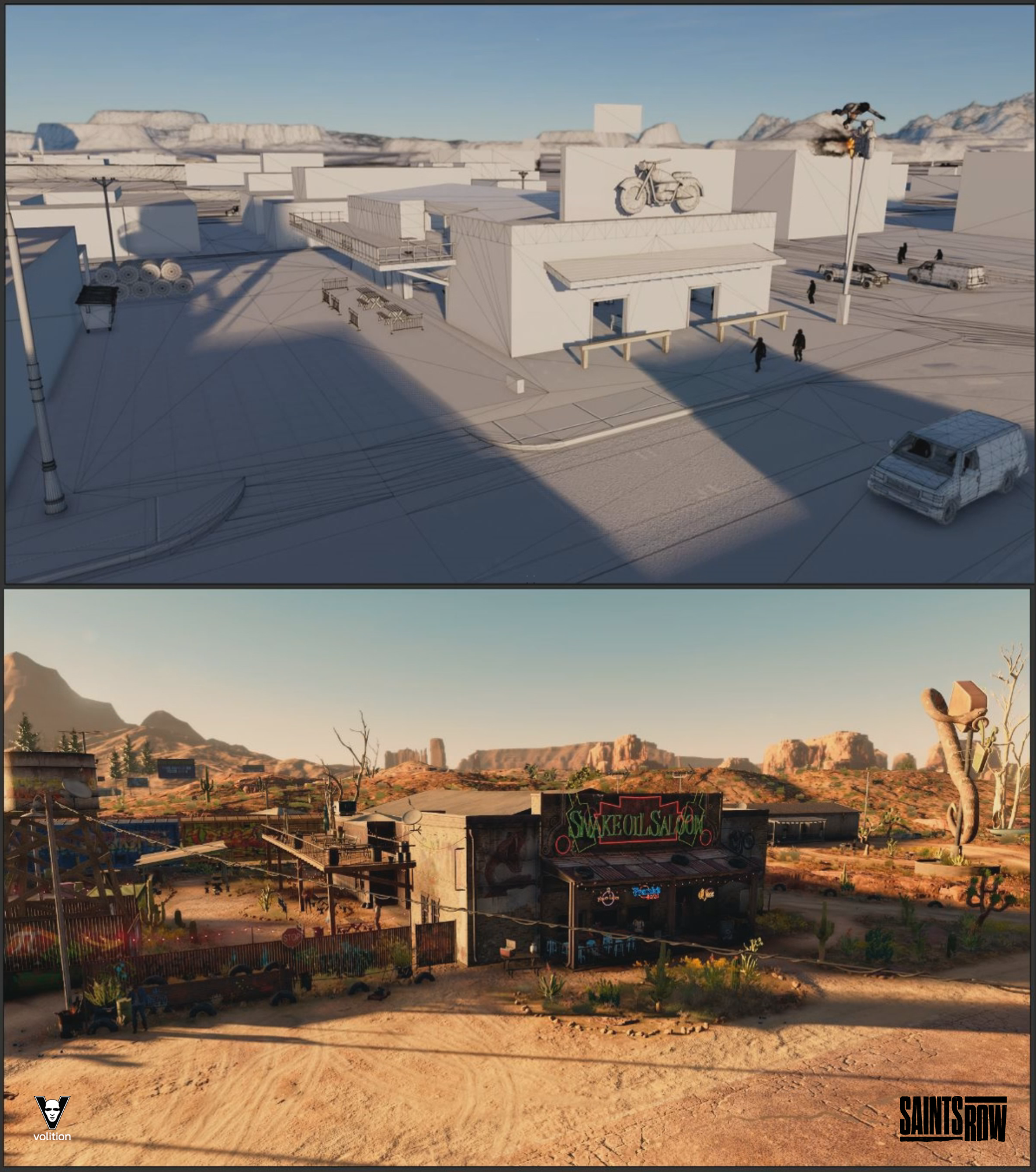
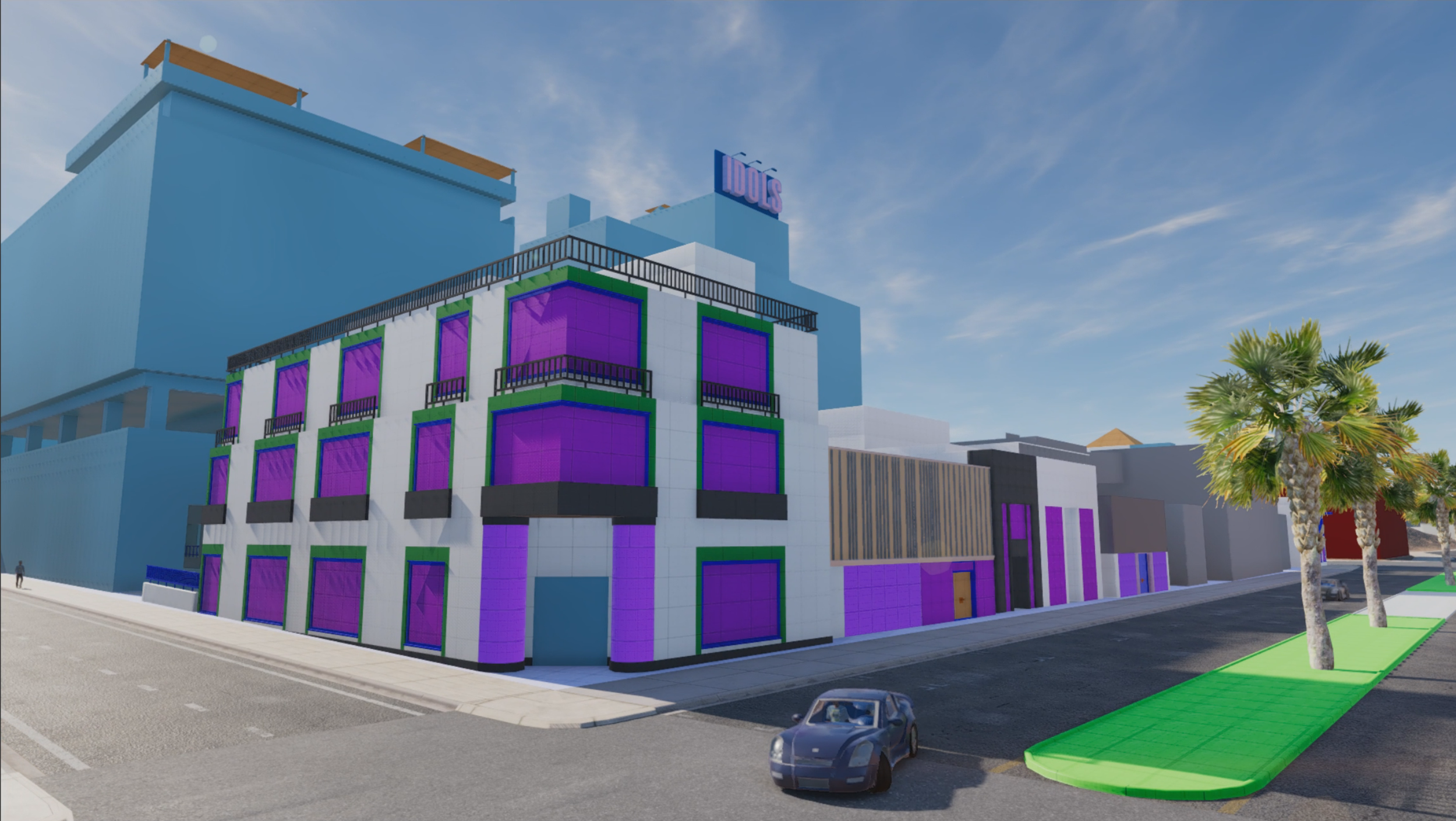
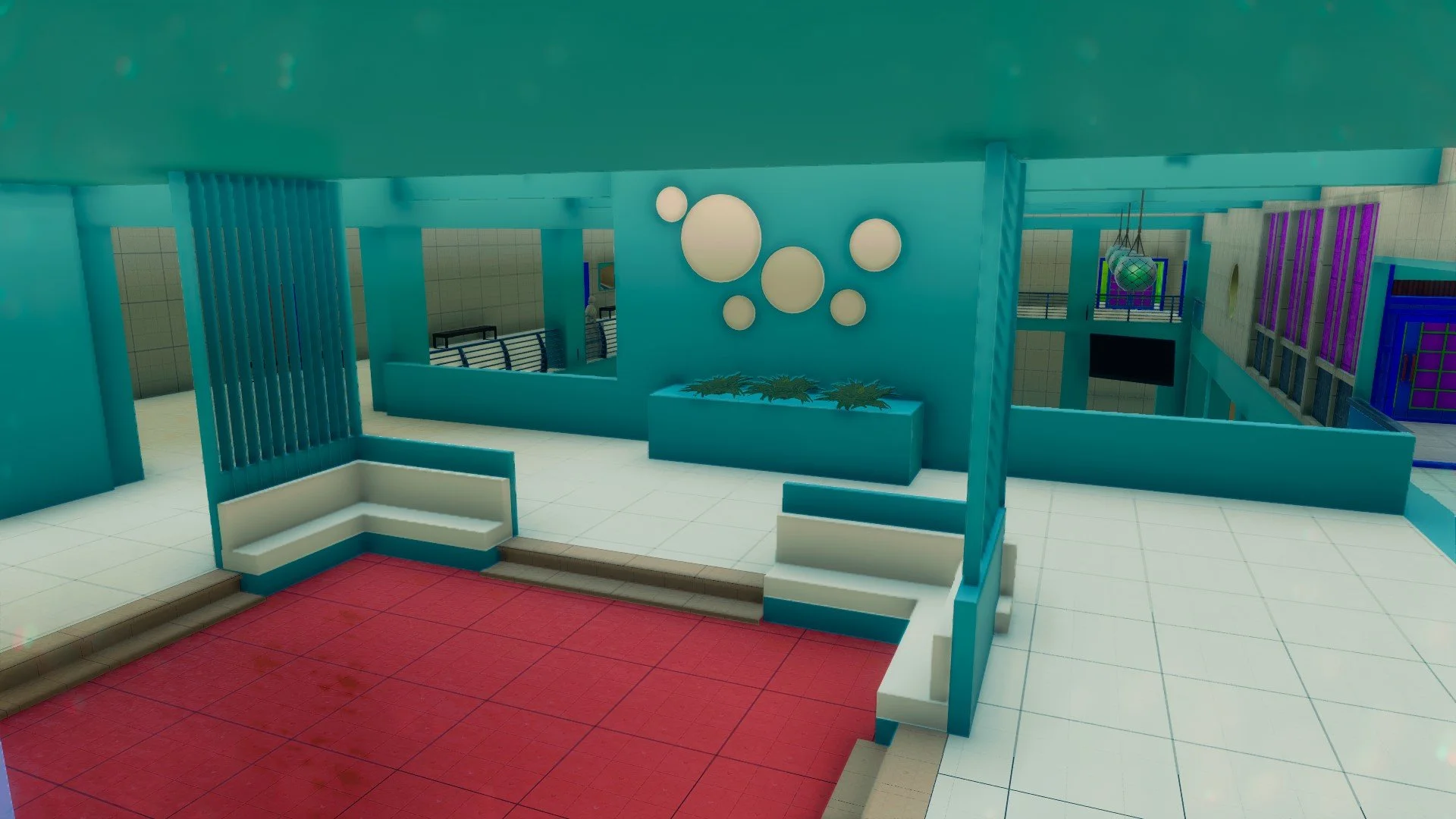
One my favorite early structures, the Biker Bar. Interior and Exterior. It was a featured location in our Vertical Slice and later used in an Idols mission.
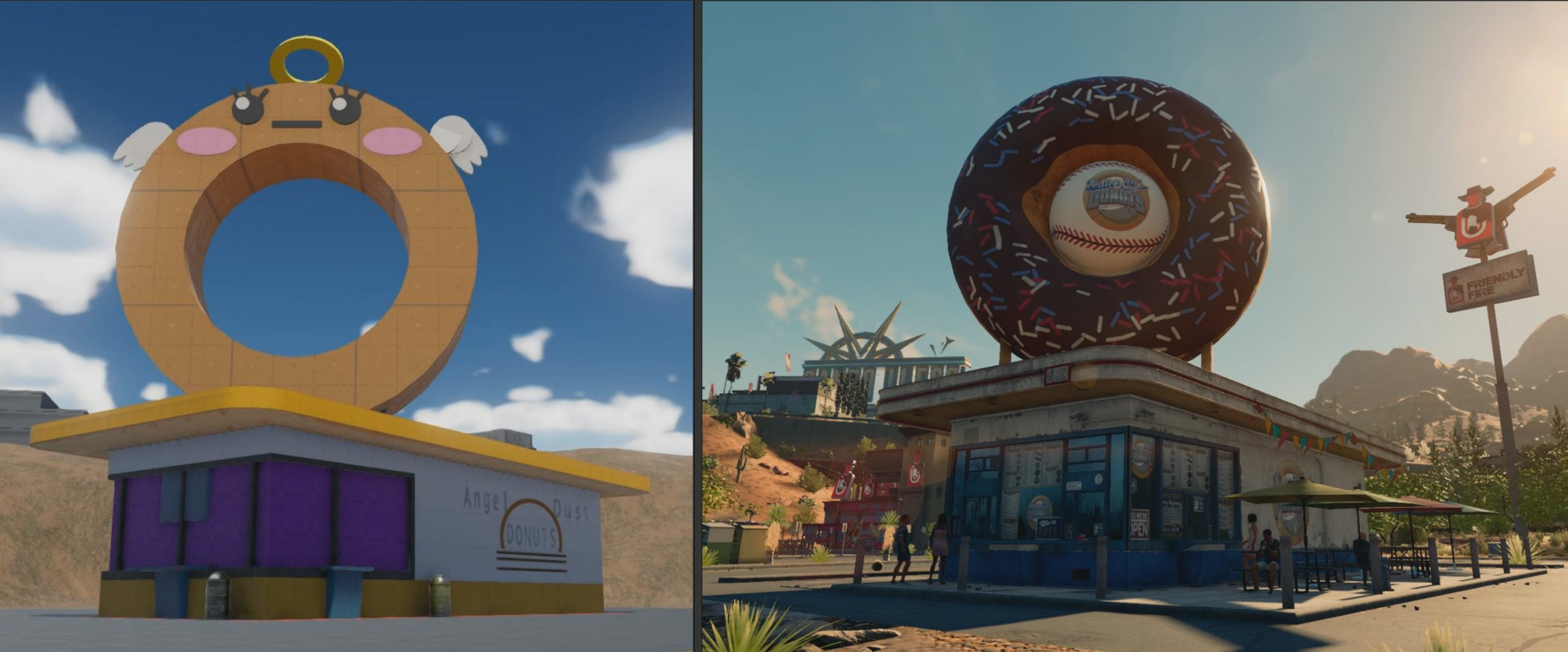
The Classic Donut Shop.
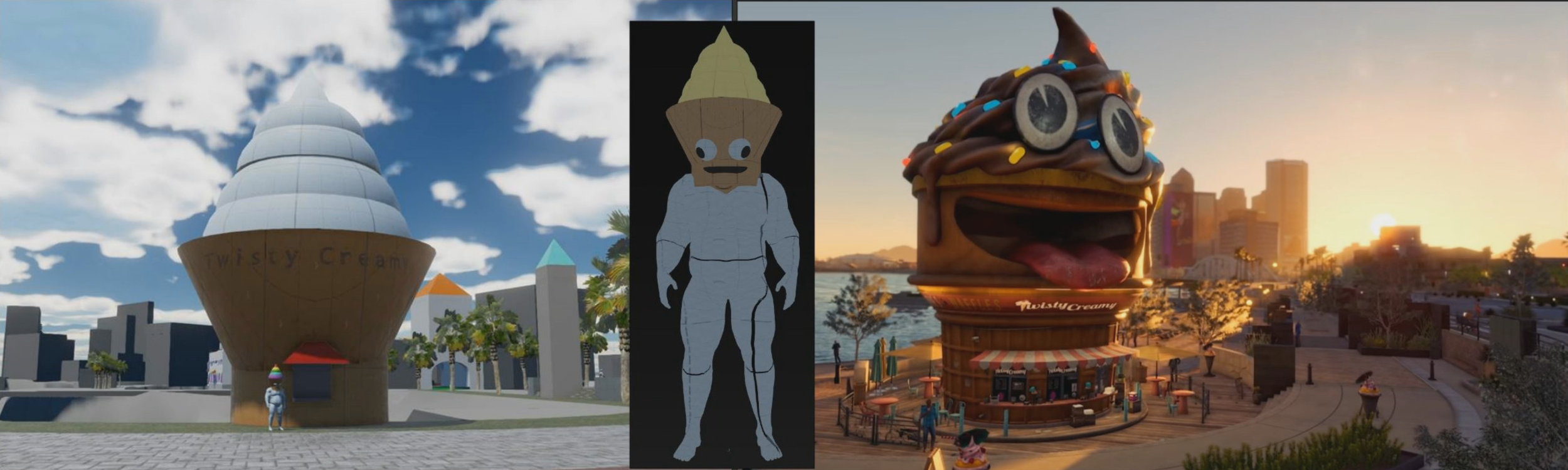
What started out as an inside joke stuck around and lead to an in-game store, a character mascot, and player outfits
Building a District
Every district would start with concept art and documentation written by directors detailing the high level vision, narrative goals, and key inspirational references. With that in hand I would collaborate with the Environment Art Lead on specific details for the district such as architecture styles, points of interest, and the socioeconomic status of the district. We’d gather tons of photo/video references. Then we’d start arranging ideas into reference boards. I’d work with Narrative, Missions/Open world designers to figure out what the specific gameplay needs were. From there I’d organize all the various data points and begin painting 2D maps of the district. Planning out the main navigational routes (on-foot and vehicles), landmarks, vistas, shortcuts. Making sure it all stayed within gameplay metrics.
Using Volition’s in-house City Planner tools I’d quickly create playable district in a few hours. Get feedback, iterate, gather more info, draw another map, and repeat.
Design Creation Process
Below is a simplified walkthrough of the district creation process at the start of the project.
The first step is capturing all the ideas on paper. Thinking through distribution of themes & content. How big might an average block be?
Next step is solving terrain and elevation. How does this district fit with the natural landscape? How might the people who live there build with the terrain and what kind of gradient can our tools support? I knew that I wanted split the district over a hill with the civic buildings being at the highest point. Blockout always feel better when building with terrain, rather than grid. This is very first scale test area.
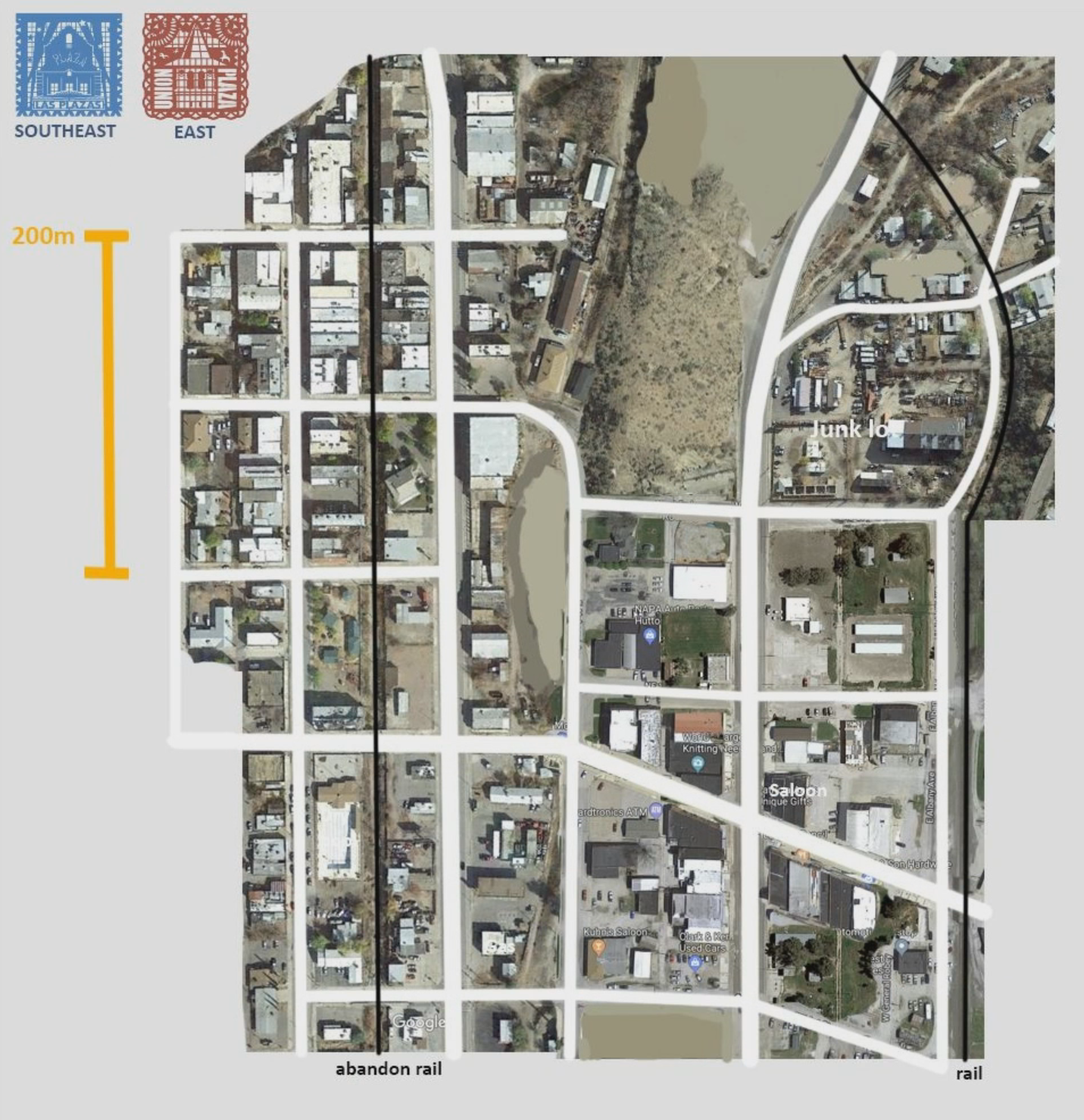
Once we're happy with the general layout. I make a Frankenstein scale map out of Satellite images & other ref sources. Using key reference city as my starting point. This method help maintain a realistic scale, and I have photo reference for anything that I need, from buildings to props, landscaping. I paint out anything I don't want and adapt as needed.
Then it was a matter of building the district in-editor using City Planner, Prefab editor, and the Road Profile editor to create any road types that I needed. Volition's tool sets were fast and powerful enough that I could built the entire district myself very quickly. With traffic and pedestrian working.
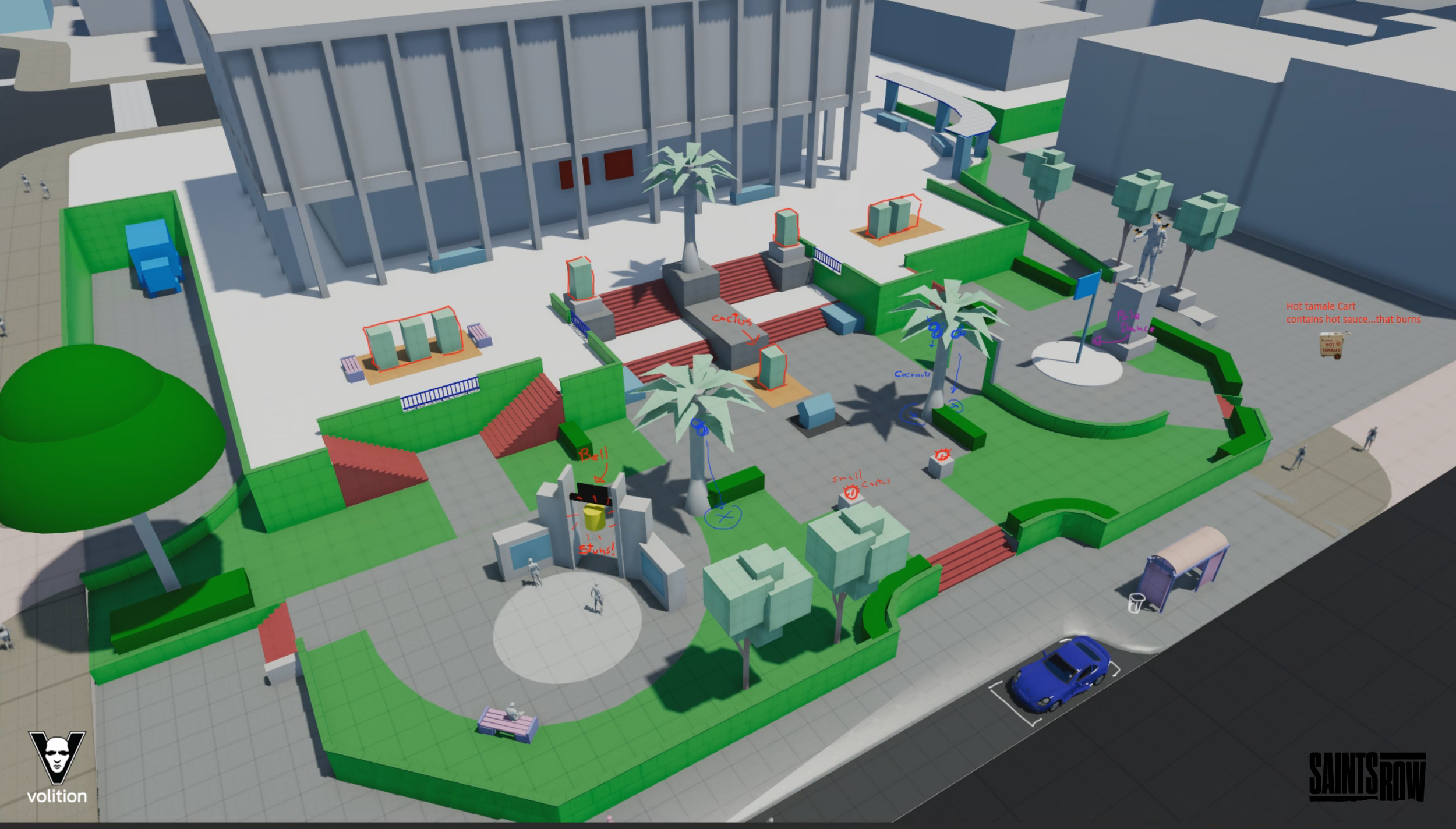
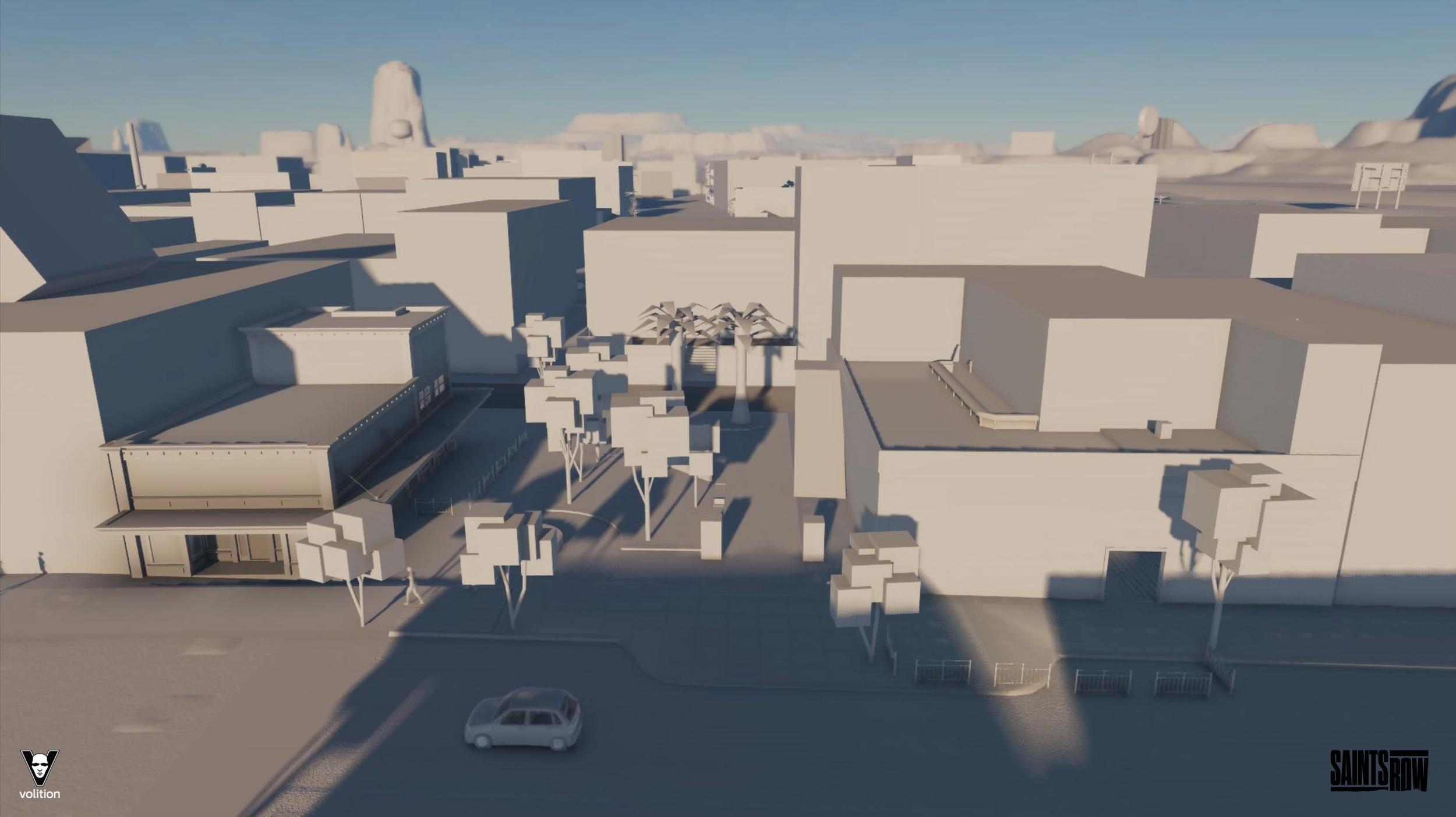
As gameplay and location became more concreate designers could quickly jump down to a block prototype location or build specific encounter spaces. This is one of the first combat space built and a testing ground for interactive environment props.
Through the process Art and Design work together to develop each district. One of the other roles for Level designer was maintain the infrastructure of the city: Traffic & GPS data, intersection timing, pedestrian sidewalk splines, parking, ambient life placement, population composition and density, day/night life and Navmesh.
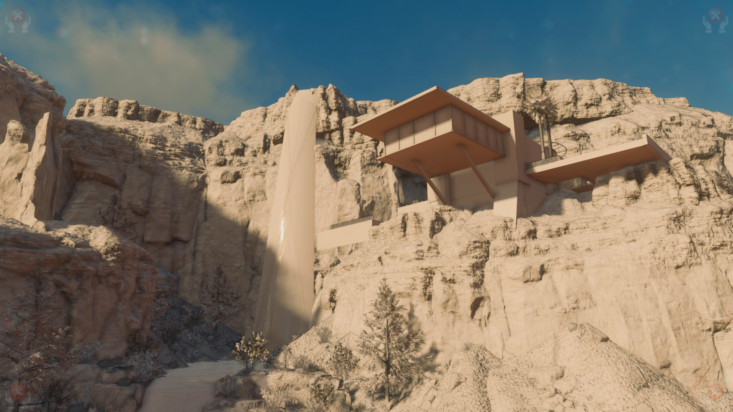
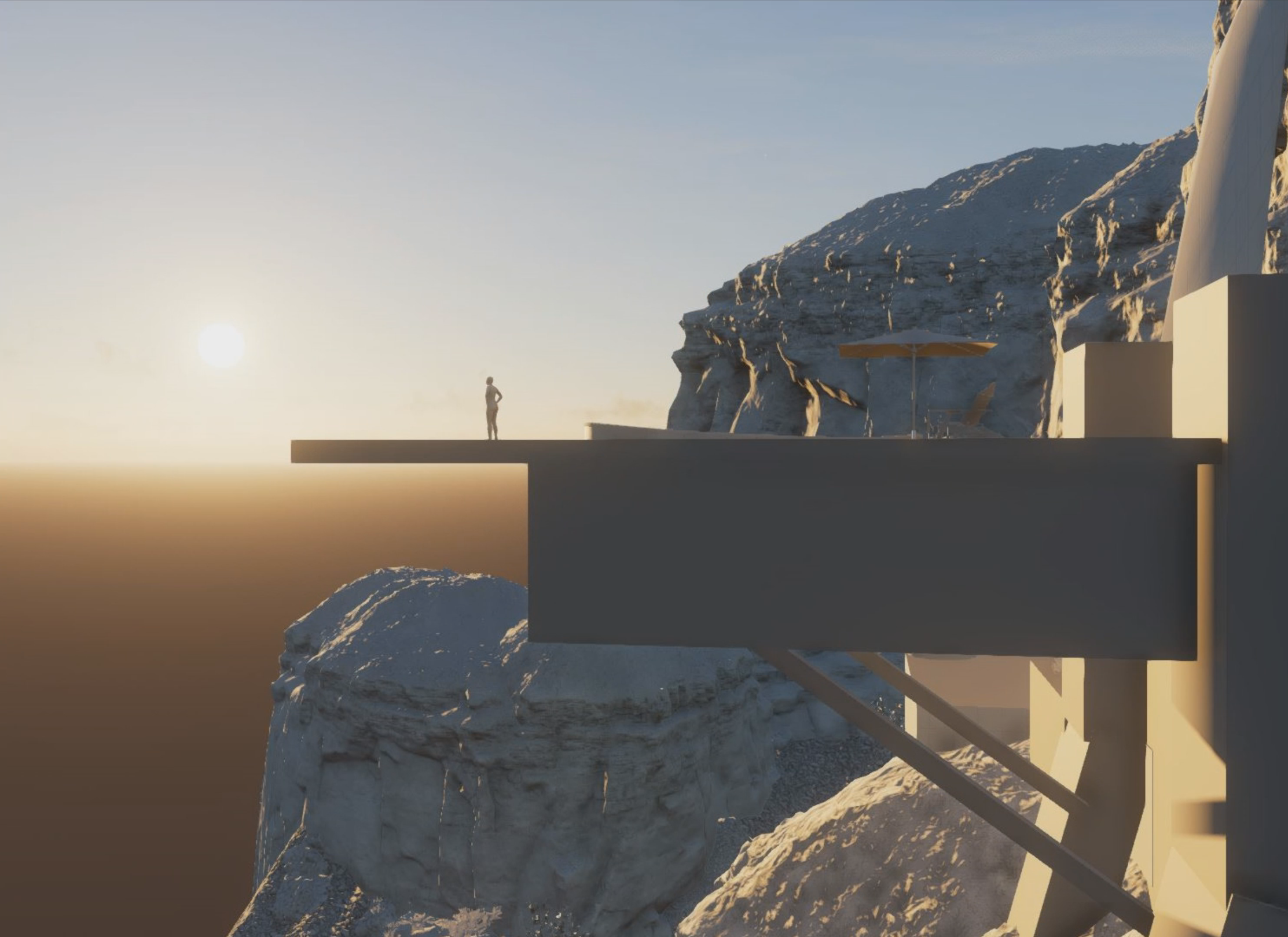
This is the Hollywood cliffside mansion I built for the Heist and the Hazardous DLC pack. A main story location. It was built for combat, but later became a cinematic location, and is rewarded to the Players as a new HQ. Inspired by homes of the Rat Pack in Palm Springs
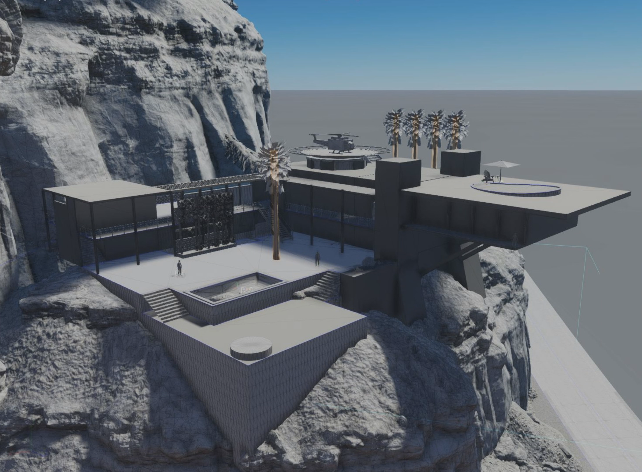
Helipad, rooftop driving range, and pool. The Pool area was intended as the combat space with a scenic view of the Spring. I started with the cliff face and waterfall then built the house and the road leading up it so that they would feel as well integrated as possible.
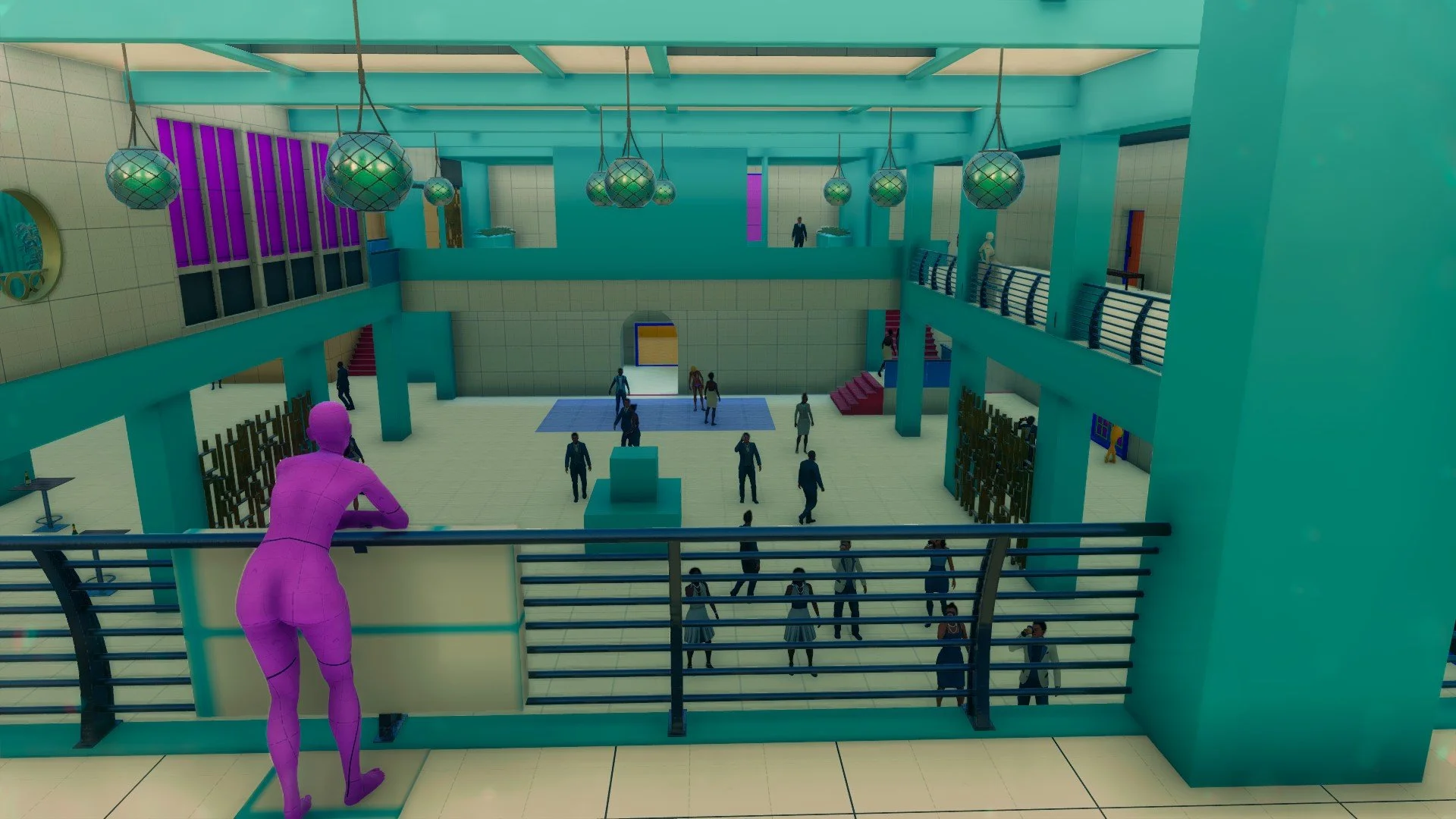
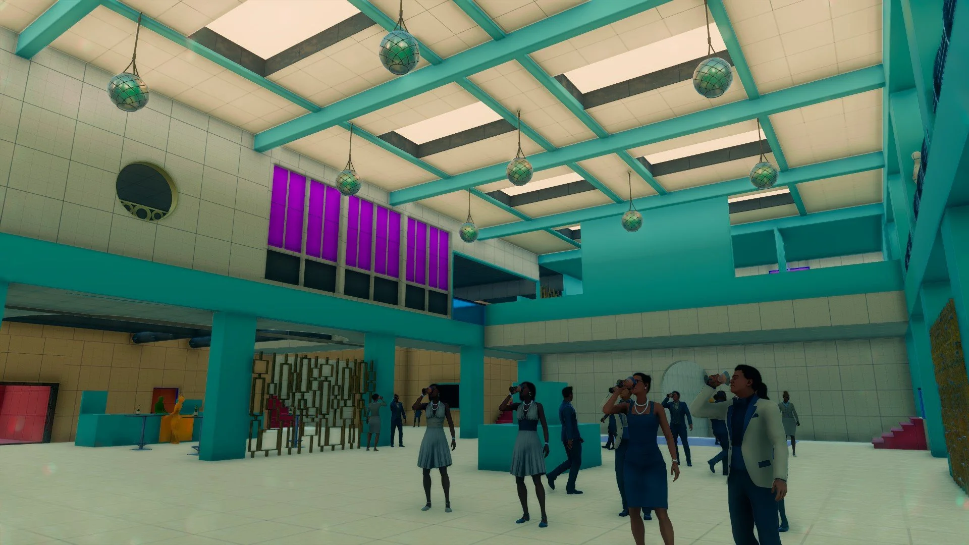
Block out for Hotel Interior for the Heist and Hazardous DLC pack
First pass of Marina Del Lago district. Goal at this phase were to create fun road networks for vehicle combat and flow. The other goal was to figure out the size of blocks, buildings. Lastly have all major POIs represented.
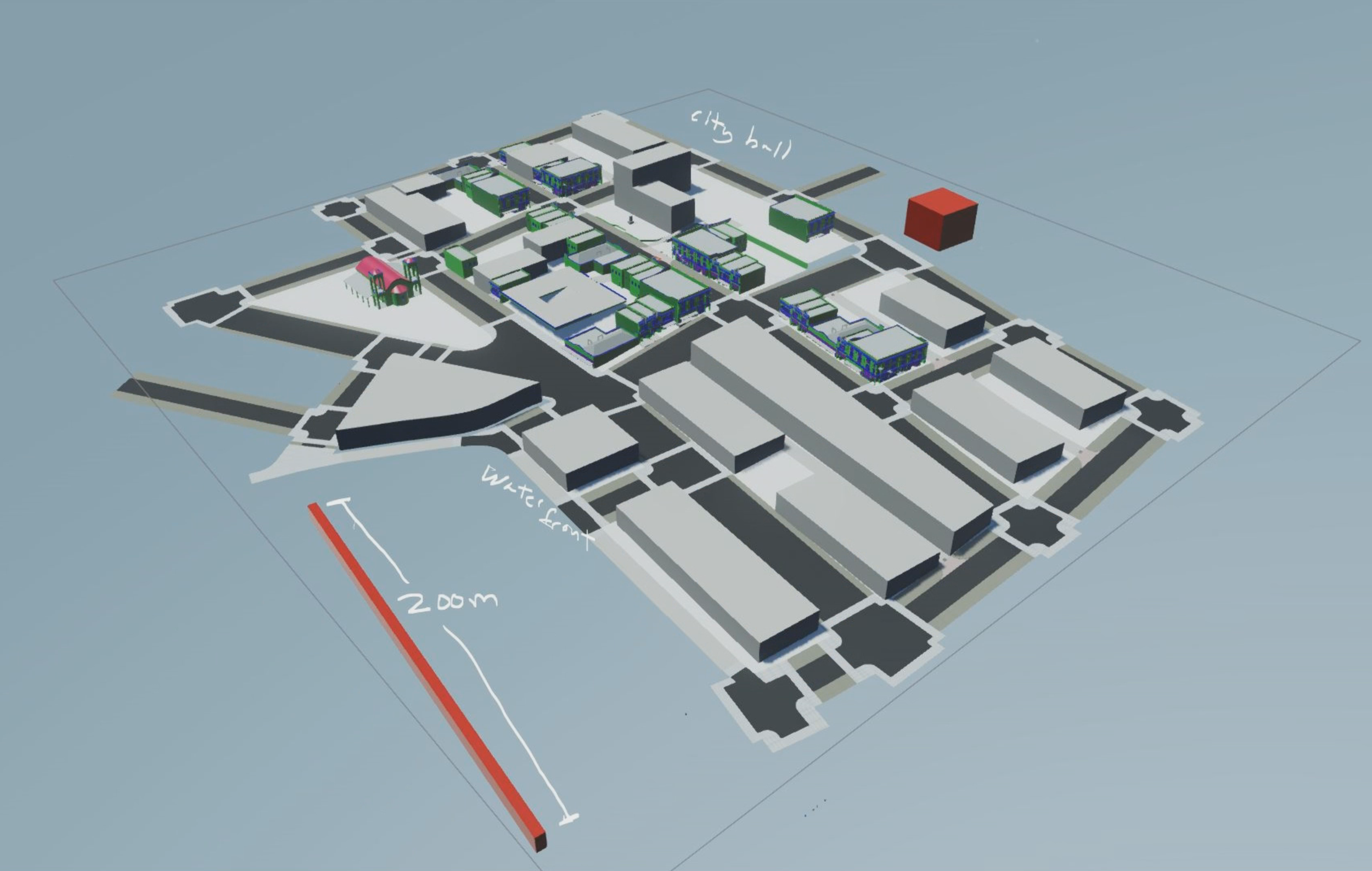
One of my 2D maps of the final Dustfaire district DLC. This is more or less the final version of the map before building the block. The blue grid represents the memory zone. While designing any map it was important keep memory limits in mind as to avoid problems down the line.
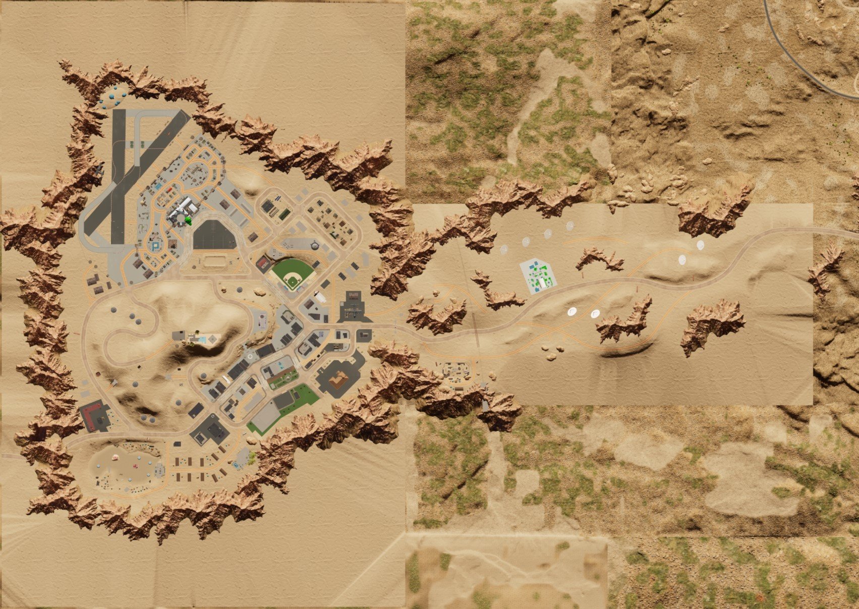
In-editor top view image of the Vallejo DLC district. Phase 2
Early blockwork and rough buildings
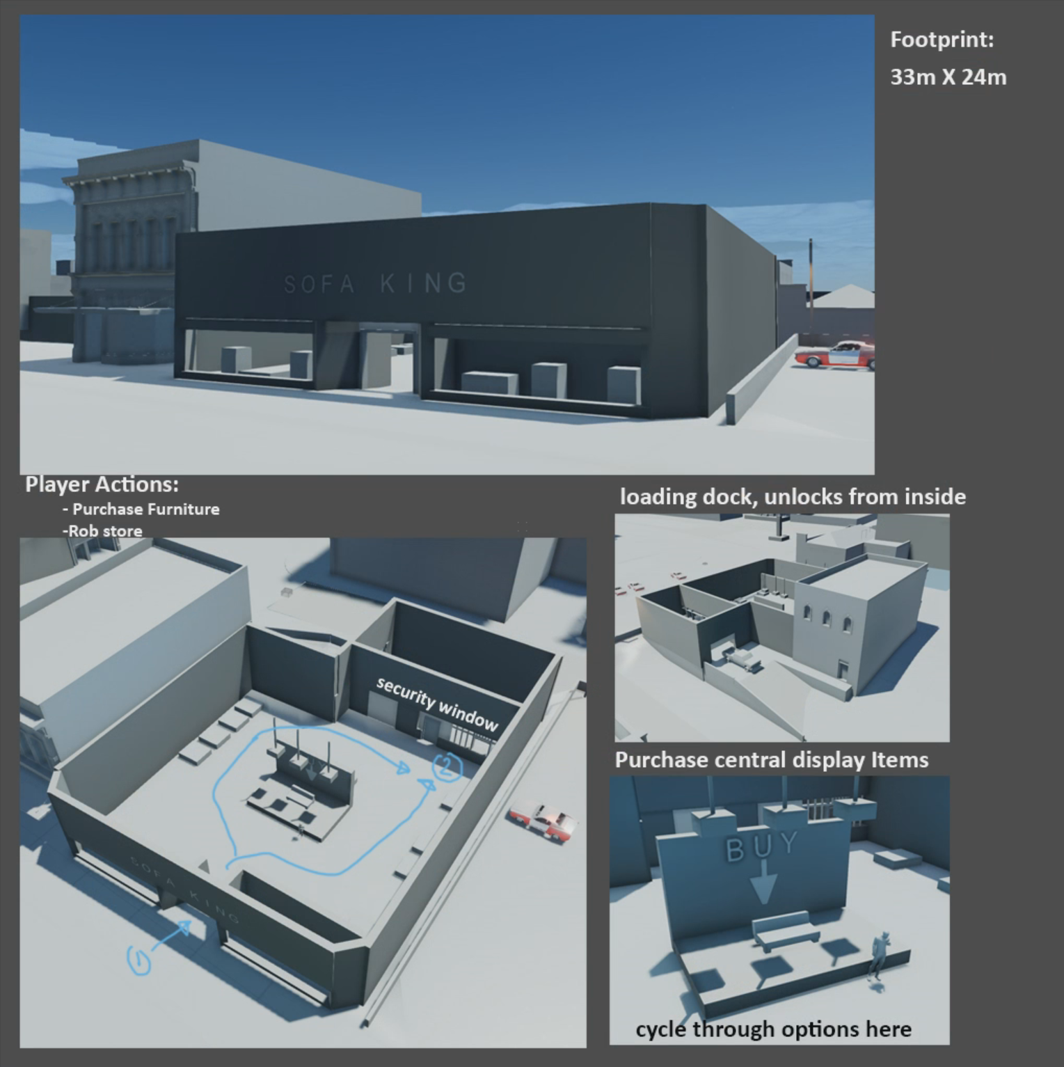
A prototype blockout for furniture shop that was a function in-game store and the player could sneak into and rob.
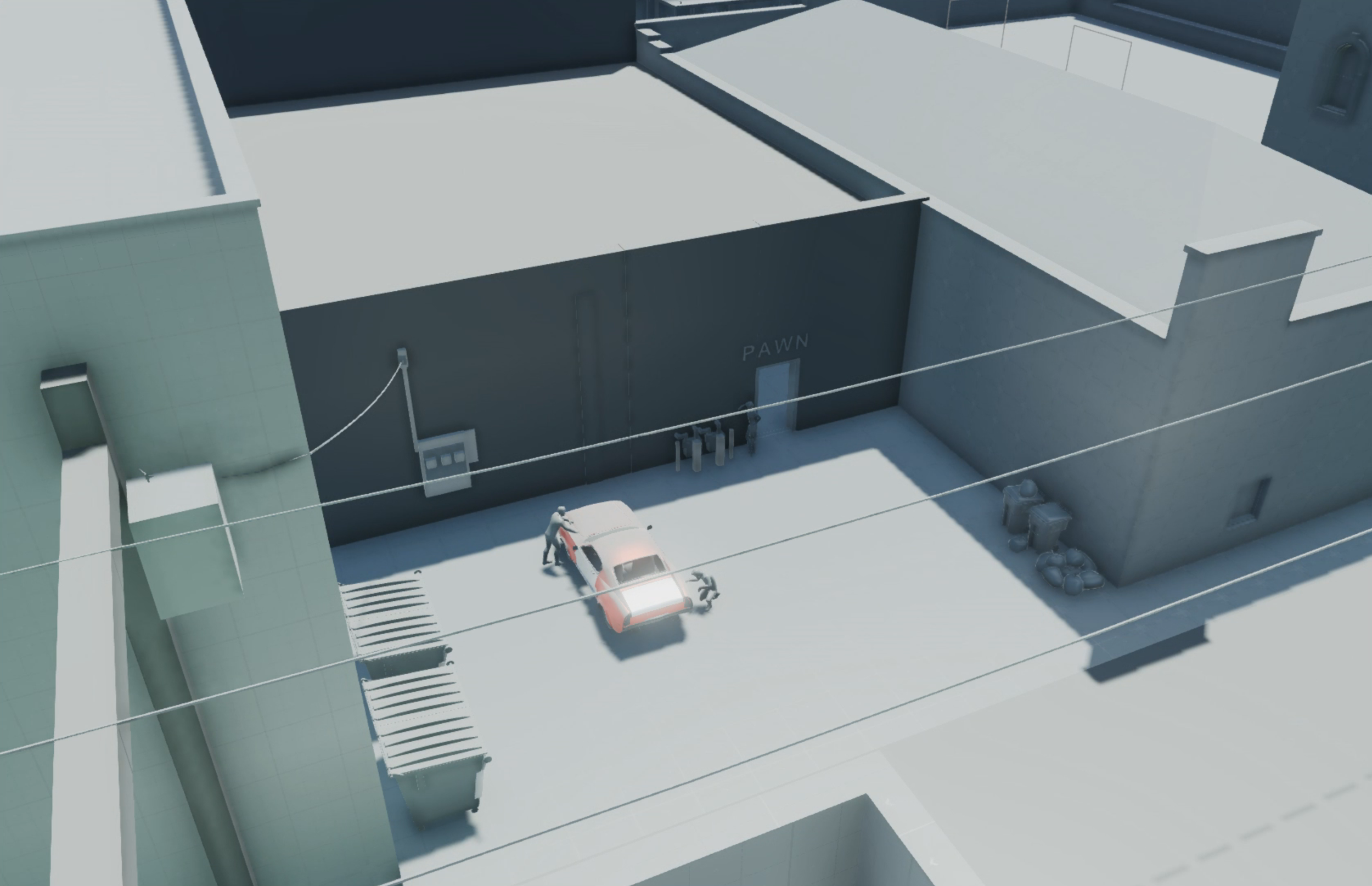
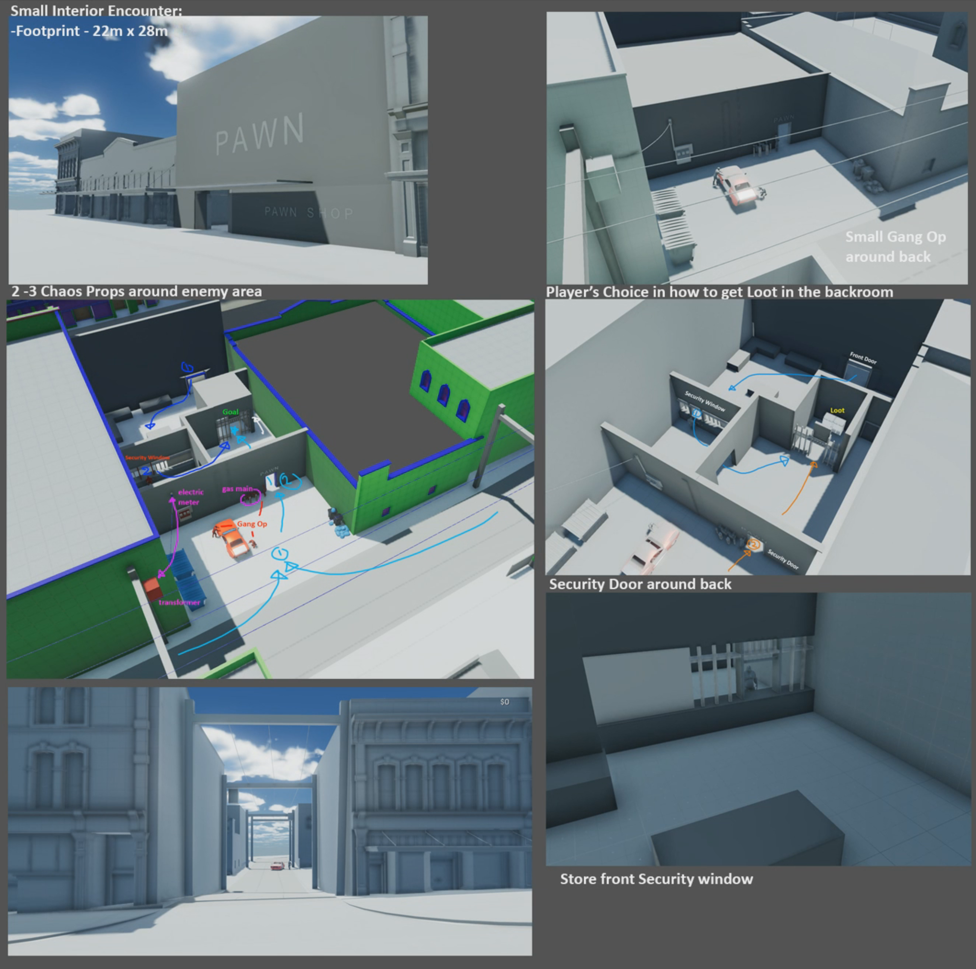
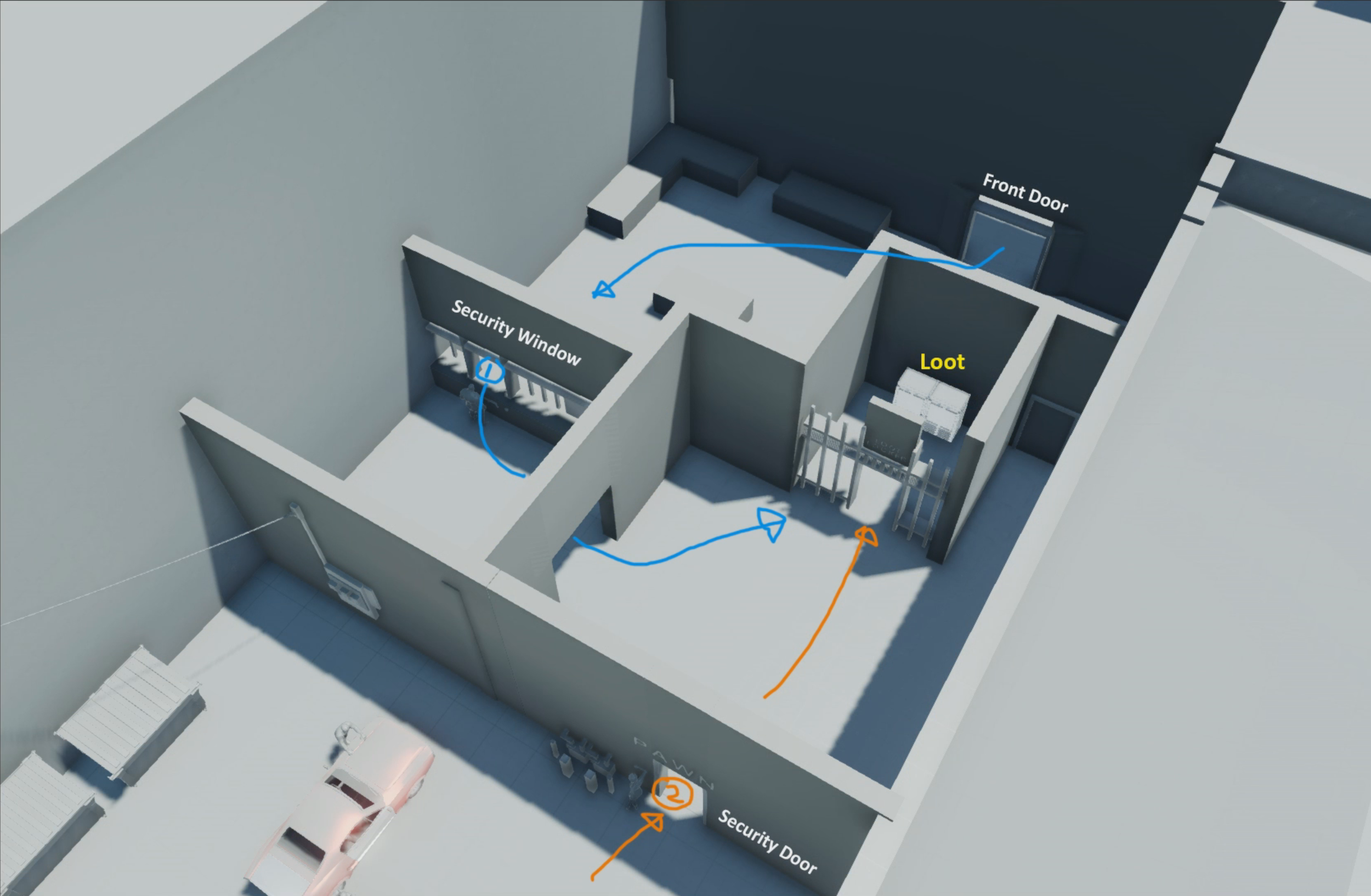
Early prototype for Pawn Shop. Exploring various ways that player could Rob as a repeatable open world activity. Either by sticking up the clerk, or busting down the back security door.
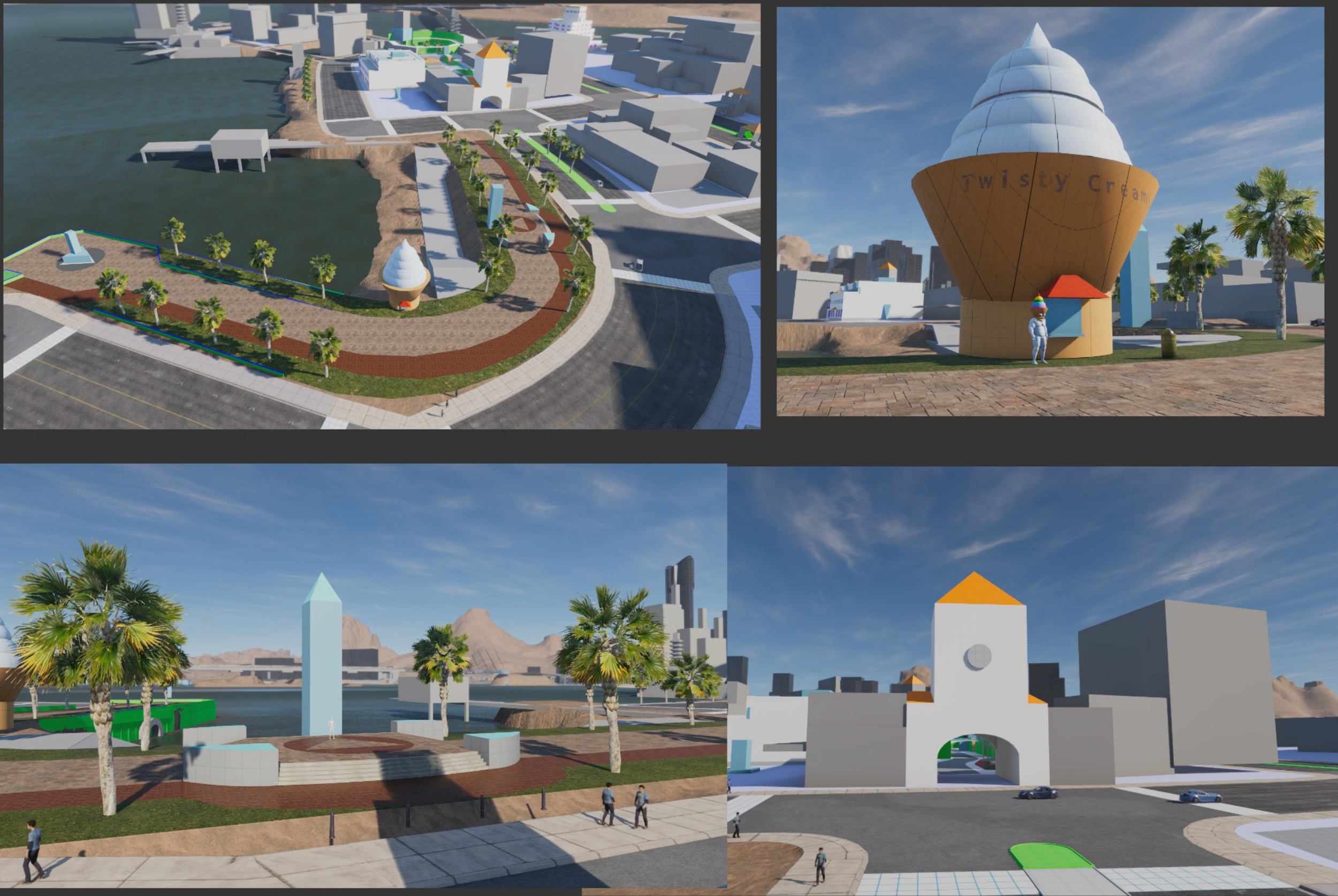
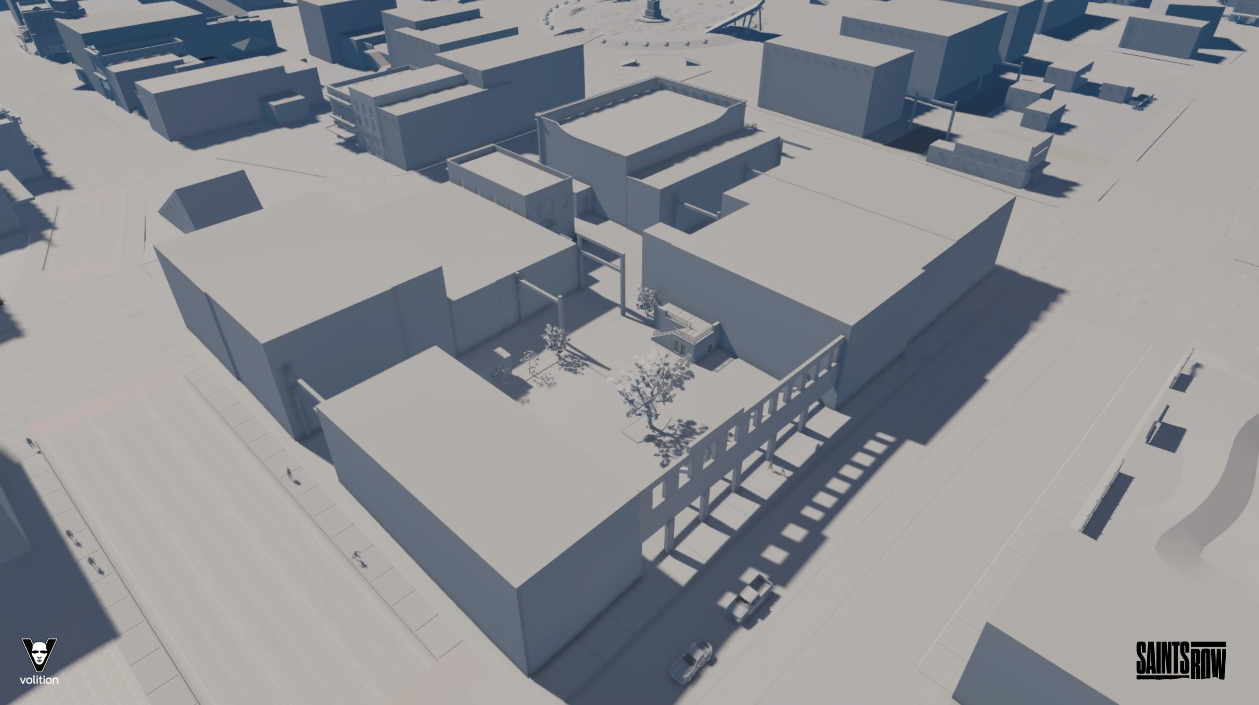
Early blockout of the Marina Del Lago district. Internally called the Rodeo District
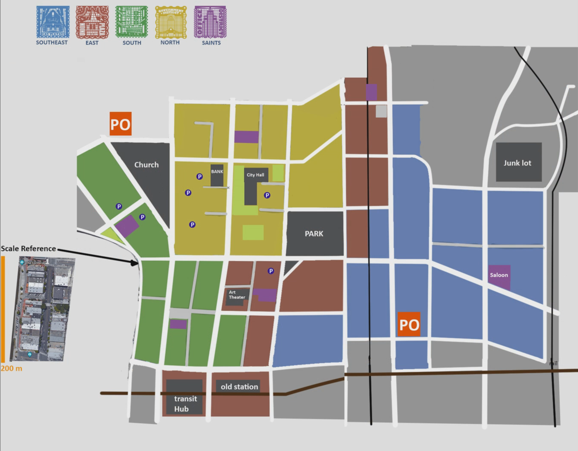
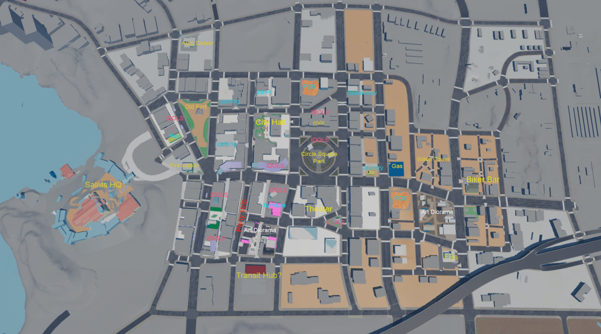
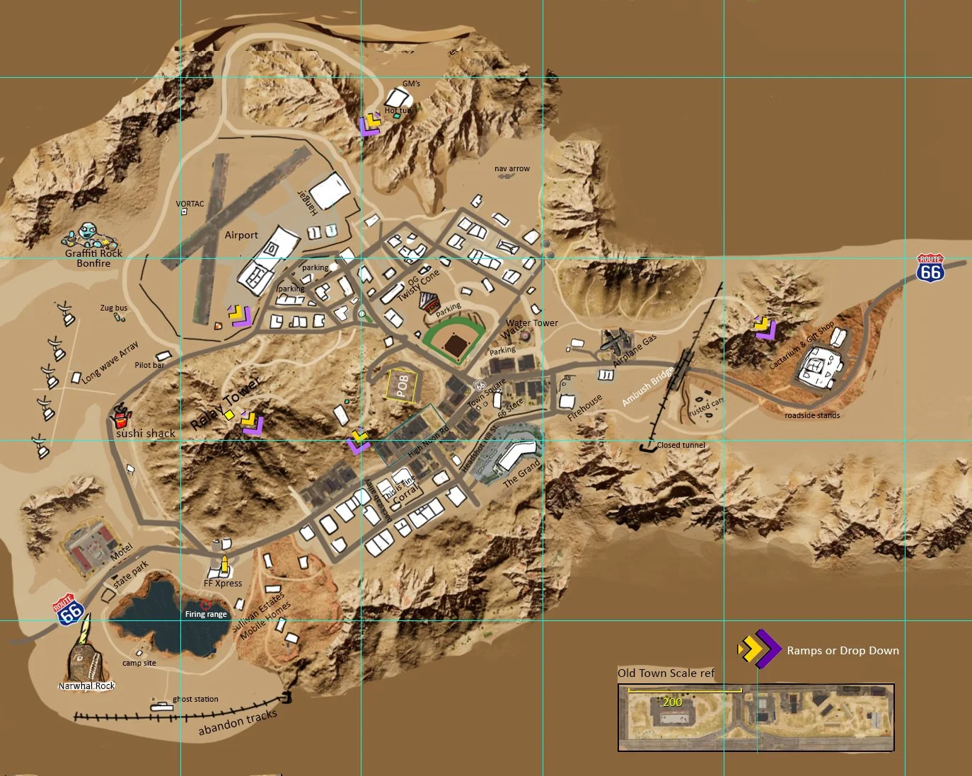
Reference POI map for Old Town District map